


Around c. 1700 BCE, the Ancient Near East was a politically fragmented but highly interconnected region, shaped by shifting alliances, commercial networks, and emerging territorial states. This period corresponds to the Old Assyrian era and precedes the full consolidation of power in southern Mesopotamia under Hammurabi of Babylon (reign c. 1792–1750 BCE). Rather than a single dominant empire, the landscape was defined by competing city-states and kingdoms whose influence rested on trade, diplomacy, and military opportunism.
In Upper Mesopotamia, the city-state of Assur, situated on the Upper Tigris, was transitioning from a mercantile hub into a more assertive political power. Assyrian merchants operated extensive long-distance trade networks, most notably through colonies such as Kanesh (Kültepe) in Anatolia, linking Mesopotamia with metal-producing regions to the north. At the same time, central Anatolia witnessed early political consolidation under Anitta of Kussara (reign c. 1740 BCE), a precursor to the Early Hittite state. Elsewhere, established powers such as Mari under Zimri-Lim (reign c. 1775–1761 BCE) and Eshnunna were weakening, while Babylon, under Hammurabi, was poised to exploit this instability. Together, these developments marked a critical transitional moment, setting the stage for new imperial formations that would reshape the Near Eastern political order in the decades that followed.
About the Author

Related Images

Map of Mesopotamia and the Ancient Near East, c. 1300 BCE

Babylon at the time of Hammurabi

Ancient Syro-Mesopotamia ca. 1764 BCE

Ancient Near East c.1500-1300 BCE - The Old Hittite Collapse and the Rise of Kassites, Mitanni, and the New Kingdom of Egypt
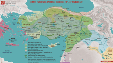
Map of the Hittite Empire 16th-13th Century BCE - Anatolian Great Power of the Bronze Age

The Ancient Near East, c. 1300 BCE - On the Eve of Collapse: Power and Politics in the Late Bronze Age
Cite This Work
APA Style
Netchev, S. (2022, January 18). Map of Tthe Ancient Near East c. 1700 BCE: The Old Assyrian Empire - between cities and kingdoms. World History Encyclopedia. https://www.worldhistory.org/image/15146/map-of-tthe-ancient-near-east-c-1700-bce/
Chicago Style
Netchev, Simeon. "Map of Tthe Ancient Near East c. 1700 BCE: The Old Assyrian Empire - between cities and kingdoms." World History Encyclopedia, January 18, 2022. https://www.worldhistory.org/image/15146/map-of-tthe-ancient-near-east-c-1700-bce/.
MLA Style
Netchev, Simeon. "Map of Tthe Ancient Near East c. 1700 BCE: The Old Assyrian Empire - between cities and kingdoms." World History Encyclopedia, 18 Jan 2022, https://www.worldhistory.org/image/15146/map-of-tthe-ancient-near-east-c-1700-bce/.