


Map depicting Medieval Japan and its trade relations with its neighbours, China and Korea. The map shows the major trade goods exchanged between Japan, China, and Korea. Black lines show the approximate routes taken by the Wako Pirates. Each of the major islands of Japan are highlighted in a different colour.
About the Author

Related Images
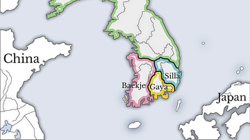
Three Kingdoms of Korea Map

Sea Routes from Ancient Japan to China
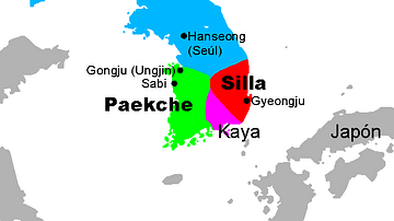
Three Kingdoms, Korea

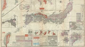
Map of Japan in the 16th Century CE

Map of the Warring States of China & Qin Conquest
Map of the Japanese Empire, 1895
Cite This Work
APA Style
Crabben, J. v. d. (2020, September 16). Map of Medieval Japanese Trade & Wako Pirates. World History Encyclopedia. https://www.worldhistory.org/image/12756/map-of-medieval-japanese-trade--wako-pirates/
Chicago Style
Crabben, Jan van der. "Map of Medieval Japanese Trade & Wako Pirates." World History Encyclopedia, September 16, 2020. https://www.worldhistory.org/image/12756/map-of-medieval-japanese-trade--wako-pirates/.
MLA Style
Crabben, Jan van der. "Map of Medieval Japanese Trade & Wako Pirates." World History Encyclopedia, 16 Sep 2020, https://www.worldhistory.org/image/12756/map-of-medieval-japanese-trade--wako-pirates/.