
Search
Remove Ads
Advertisement
Search Results
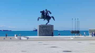
Image Gallery
A Panorama of Northern Greece
Northern Greece describes the geographical part of the Greek administrative territory that includes the regions of Macedonia and Thrace. An escape to Macedonia and Thrace for an exploration of the unparallel landscapes can reveal the hidden...

Definition
Greek Dark Age
The Greek Dark Age (c. 1200 to c. 800 BCE, overlapping with the Iron Age, c. 1200-550 BCE) is the modern-day term for the period in Greek history following the Bronze Age Collapse when the Mycenaean Civilization fell and the Linear B writing...

Definition
Pirates in the Ancient Mediterranean
Piracy, defined as the act of attacking and robbing a ship or port by sea, had a long history in the ancient Mediterranean stretching from the time of the Egyptian pharaoh Akhenaten (r. 1353-1336 BCE) and throughout the Middle Ages (c. 476-1500...

Collection
Warfare in Classical Greece
The ancient Greek city-states were in a constant rivalry for land, resources and power which meant that warfare became an ever-present aspect of life. Athens and Sparta were famous rivals throughout the Classical period but other cities like...

Definition
Portuguese Angola
Portuguese Angola in southwest Africa was the first European colony on that continent. While settlement from 1571 proved problematic in the interior, the Portuguese did obtain a large number of slaves which they shipped to their Atlantic...

Definition
Ancient Egyptian Government
The government of ancient Egypt was a theocratic monarchy as the king ruled by a mandate from the gods, initially was seen as an intermediary between human beings and the divine, and was supposed to represent the gods' will through the laws...

Image
Map of the East India Company Trade, c.1800
The English East India Company (EIC) was established by Royal Charter on 31 December 1600 under Queen Elizabeth I (reign 1558–1603), granting it a monopoly on English trade east of the Cape of Good Hope. Initially conceived as a commercial...
Image
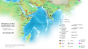
Ancient Indian Maritime Trade Routes
This map is derived from the book Periplus of the Erythraean Sea. It depicts trade routes in the ancient world, ports in the Chera territory and other parts of India and the trade routes connecting them to other parts of the world along with...
Image
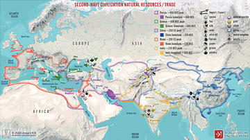
Second-Wave Civilization Natural Resources and Trade
A map illustrating the rise and spread of the Second Wave Civilizations between c. 500 BCE and 200 CE (including the Persians, the Greeks, the Romans, the Chinese, and India) with the flows of trade in major goods and resources.

Definition
Portuguese Malacca
The Portuguese colonised Malacca (modern Melaka) on the southwest coast of the Malay peninsula from 1511 and kept it until 1641 when the Dutch took over. The port controlled the Malay Straits which lead from the Indian Ocean (the Andaman...