Search
Search Results

Image
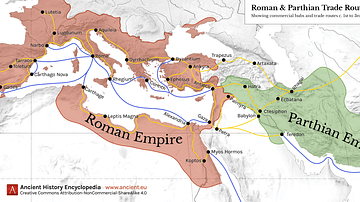
Map of Roman & Parthian Trade Routes
This map shows the Roman-Parthian trade route system, circa between the 1st and the 3rd centuries CE. During this period, the Roman Empire and the Parthian Empire were the two superpowers of the region and the Roman-Parthian trade system...

Image
Trade Networks in the Middle Ages, c. 1200
A map illustrating the interconnectivity and extent of the global trade networks at the onset of the 13th century after the centuries of decline and isolation following the collapse of the Western Roman Empire. The conditions were beginning...

Image
The African Slave Trade, c. 1750
By 1750, Africa had emerged as the center of three major slave-trading systems: the transatlantic, trans-Saharan, and Indian Ocean trades. These interconnected networks linked African societies to European, Middle Eastern, and Asian markets...

Image
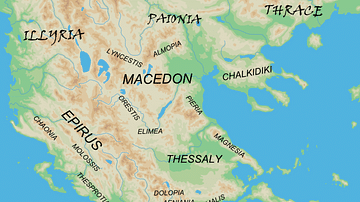
Regions of Ancient Greece
A map of the primary regions of ancient Greece's mainland along with its northern neighboring tribes.

Image
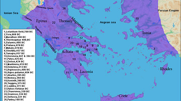
Battles of Ancient Greece
A map showing the locations of battles in ancient Greece.

Image
Trade Union Scroll for the Amalgamated Society of Engineers
A trade union scroll for the Amalgamated Society of Engineers, created in January 1851. The scroll shows illustrations of important engineers and inventions during the Industrial Revolution. (Science Museum, London)

Quiz
Roman Trade & Economy
Roman economy trade Amphora, Amphorae Argentarii Commerce Free Market Economy Garum Mensarii Mint Nummularii Pax Romana Princeps State-Controlled Economy Veto

Image
Map of the Trade Links between Rome the East (1st - 3rd
This map illustrates the shifting web of overland and maritime routes—later dubbed the “Silk Road”—that linked China, India, and Southeast Asia with Persia, the Eastern Mediterranean, and Europe. From desert caravans to monsoon-powered ships...

Image
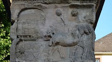
Relief Showing a Scene of Cloth Trade
Relief from the Igel Column depicting mules pulling a four-wheeled chariot cart laden transporting bales of cloth. The Igel Column is a multi-storey Roman sandstone funerary monument located on the left bank of the Moselle some eight kilometres...

Video
Roman Trade with Africa DOCUMENTARY
We are continuing our new animated historical documentary series on the Roman trade and economy with a video on the trade with Africa. Previously we have covered the Roman trade with India https://www.youtube.com/watch?v=eDTaOOVbxLs and the...