
Search
Remove Ads
Advertisement
Search Results

Image
Map of the Mediterranean Trade Networks, c. 700–350 BCE - Commerce & Colonization in the Archaic and Classical Ages
Between c. 700 and 350 BCE, the Mediterranean formed part of a broad and increasingly interconnected system of maritime and overland exchange linking...

Image
Map of the Late Bronze Age Mediterranean Trade Networks - Trade, Diplomacy & Interdependence, c. 1400–1200 BCE
Between c. 1400 and 1200 BCE, the eastern Mediterranean and Aegean formed a densely interconnected system of exchange linking the Mycenaean palace states...

Image
The Columbian Exchange - Global Connections and Consequences after 1492
The Columbian Exchange (from 1492 CE) refers to the large-scale transfer of plants, animals, diseases, peoples, and technologies between the Americas and Afro-Eurasia following the transatlantic...

Image
Map of European Expansion and Global Trade Empires, c.1700
By the 18th century, European power had become truly global through a combination of maritime expansion, state-backed commerce, and military force. The leading Atlantic empires, Spain, Portugal...

Image
Map of The Olmec World and Its Mesoamerican Connections - Power, Resources, and Interaction Networks, c. 1500–400 BCE
The Olmec world developed in the tropical lowlands of present-day Veracruz and Tabasco during Mesoamerica’s Formative period (c. 1500–400 BCE). Major...

Image
Map of Ibn Battuta’s Travels, 1325-1354 - Medieval Travel, Scholarship & Connectivity in Afro-Eurasia
Ibn Battuta ((Abū Abd Allāh Muḥammad ibn Abd Allāh Al-Lawātī, 1304–c. 1368 CE) was a traveler, jurist, and scholar from Tangier whose journeys across Afro-Eurasia...
Article
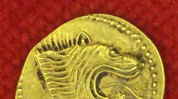
Etruscan Trade
The Etruscan civilization flourished in central Italy between the 8th and 3rd century BCE, and their prosperity was largely based on their exploitation of local mineral resources, both through manufactured goods and trade. The...

Article
Stalin's Five-Year Plans - Collectivising Agriculture & Industrialising the USSR
Joseph Stalin's five-year plans (1928-50) were a series of state-led initiatives which aimed to grow the economy of the USSR, rapidly industrialise what was still a largely agricultural...

Image
Map of the East India Company's Rise to Power, c. 1765 - Robert Clive and the Making of Company Power in India
The British East India Company's (EIC) rise to power in India accelerated between 1757 and 1765 as a commercial corporation increasingly acquired military...

Image
Map of Spanish Conquest in Northern South America - Andes, Amazon & Caribbean Expeditions, 1499–1561
Spain’s rapid expansion into South America followed the consolidation of its Caribbean footholds by 1512, marking a decisive shift from exploration to imperial...
