
Search
Remove Ads
Advertisement
Search Results

Article
HMS Victory - Nelson's Flagship & Oldest Ship of the Royal Navy
Smasher of Napoleon's invasion dream, veteran of three major wars, and scene of the death of the Royal Navy's greatest hero, HMS Victory is one of Britain's most famous warships. Curiously, and despite being on permanent display as a tourist...
Article
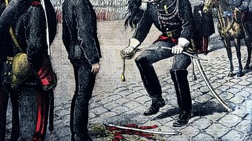
The Dreyfus Affair & the Separation of Church and State in France
The Dreyfus Affair, or L'Affaire as it has become known, demonstrated the competing forces at work to either reestablish the monarchy and the Church in power or to solidify and advance the unfulfilled ideals of the 1789 French Revolution...

Article
Veuve Clicquot - The Champagne Queen
Innovative, a risk-taker, and utterly relentless in her will to overcome all obstacles, one woman not only matched but beat her competitors in the male-dominated champagne industry to establish the brand with the inimitable mango-orange label...

Collection
17 Campaigns & Battles of Napoleon
Napoleon Bonaparte (1769-1821), Emperor of the French, was one of the most successful military commanders of the modern era. From relatively humble beginnings, he rose to prominence during the tumultuous wars of the French Revolution, ultimately...

Video
Kutuzov: A Life in War and Peace with Alexander Mikaberidze
Kutuzov: A Life in War and Peace by Alexander Mikaberidze is about a character, a historical figure, but also the main protagonist of the book that many people claim to have read, but very few actually manage to get through, War and Peace...

Definition
Napoleon's Campaign in Egypt and Syria
The French Expedition to Egypt and Syria (1798-1801), led by Napoleon Bonaparte, aimed to establish a French colony in Egypt and to threaten British possessions in India. Despite initial French victories, the campaign ultimately ended in...

Definition
Cadoudal Affair
The Cadoudal Affair, or the Pichegru Conspiracy, was a failed royalist attempt to kill or kidnap Napoleon Bonaparte (1769-1821), then the First Consul of the French Republic, and restore the House of Bourbon to the French throne. The conspiracy's...

Image
Map of the French Revolution and Wars 1789-99
The French Revolution (1789–1799) also known The Revolution of 1789 to distinguish it from the ones of 1830 and 1848, was a transformative decade that reshaped France and reverberated across Europe. Sparked by economic crisis, social inequality...

Image
Napoleon and his Staff during the War of the Sixth Coalition
French Emperor Napoleon I (r. 1804-1814; 1815) and his staff during the French campaigns of the War of the Sixth Coalition. Within months, the Napoleonic Empire would be toppled. Oil on canvas by Jean-Louis-Ernest Meissonier, 1864. Musée...

Image
Levin August von Bennigsen
Count Levin August von Bennigsen (1745-1826), a German-born soldier in the service of the Russian Empire during the Napoleonic Wars (1803-1815). He led Russian forces at the battles of Eylau, Friedland, and Borodino, as well as several engagements...