
Search
Remove Ads
Advertisement
Search Results

Definition
Khaemweset
Khaemweset (also given as Khaemwaset, Khaemwise, Khaemuas, Setem Khaemwaset, c. 1281-c.1225 BCE) was the fourth son of Ramesses II (1279-1213 BCE) and his queen Isetnefret. He is the best known of Ramesses II's many children after...

Definition
Bronze Age Collapse - The Decline and Fall of Mediterranean Civilization
The Bronze Age Collapse (also known as Late Bronze Age Collapse) is a modern-day term referring to the decline and fall of major Mediterranean civilizations during the 13th-12th centuries...

Definition
Gupta Empire
The Gupta Empire stretched across northern, central and parts of southern India between c. 320 and 550 CE. The period is noted for its achievements in the arts, architecture, sciences, religion, and philosophy. Chandragupta I (320...

Definition
Ancient Indian Warfare
War was the chief means by which territory was annexed or rulers defeated in ancient India, which was divided into multiple kingdoms, republics and empires. Often one empire predominated or different empires co-existed...

Image
Unified Silla Kingdom Gold Buddha
A gold Buddha statuette from the Unified Silla Kingdom (668-918 CE), Korea. From a stone pagoda at the Hwangbok-sa temple site, Gyeongju before 706 CE. Height 12.5 cm (National Museum of Korea, Seoul, South Korea)

Image
Buddhist Stele, Unified Silla Kingdom
A soapstone Buddhist stele from the Unified Silla Kingdom of Korea. From the Piamsa Temple. The scene depicts Buddha and disciples with apsaras looking on. Height: 40 cm, c. 673 CE. (National Museum of Korea...

Video
Egypt: New Kingdom
This video summarises the main events and developments of Egypt's New Kingdom.
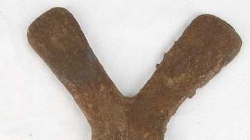
Image
Copper Curency Ingot, Luba Kingdom
A copper cross used as a currency by such central African states as the Kingdom of Luba (15-19th century CE). Height: 19.5 cm. (British Museum, London)

Image
Horned Mask, Luba Kingdom
A wooden horned mask of the Kingdom of Luba (15-19th century CE), central Africa. Height: 47 cm. (British Museum, London)
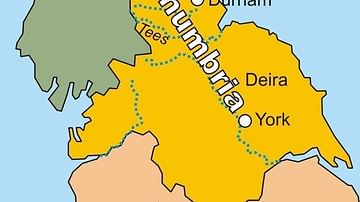
Image
Map of the Kingdom of Northumbria
A map of the Kingdom of Northumbria (c. 604-954 CE) in the northeast of Britain c. 802 CE.
