
Search
Did you mean: Bes?
Remove Ads
Advertisement
Search Results
Image
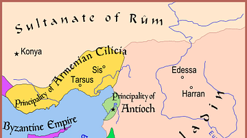
Map of The Latin East, 1190 CE
A map of the Middle East showing the Crusader-held Latin East states at the time of the Third Crusade (1189-1192 CE).
Image
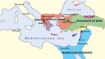
The Levant, 1263 CE
A map showing the various states of the Levant c. 1263 CE.
Light Blue: Mamluk Sultanate
Dark Blue: Latin East

Image
Baltic States 1100-1400 CE
This map illustrates the Baltic states in the period 1100-1400 CE.

Image
Northern Crusades, 1260-1410 CE
A map indicating the territories controlled by the Teutonic Knights military order and their Crusades against pagan Europeans in the 13th and 14th century CE.
Image
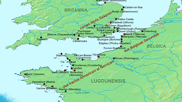
Map of the Saxon Shore, c. 380 CE
The Late Roman fortifications of the "Saxon Shore" (litus Saxonicum) in Britain and France.

Image
France, c. 1420 CE
Map of France during the Hundred Years' War (1337-1453 CE), around the time of the Treaty of Troyes (1420 CE).
Image
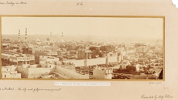
View of Medina, c. 1880 CE
A photograph of the Islamic holy city of Medina, taken from the north-side by Colonel Muhammad Sadiq Bey on his second visit in c. 1880 CE. The Masjid al-Nabwi (or The Mosque of the Prophet Muhammad (c. 570 - 632 CE...

Video
Siege of Constantinople 717-718 CE - Arab-Byzantine Wars
The forces of the Rashidun Caliphate achieved a decisive victory against the Byzantines at Yarmouk in 636. This allowed the Muslims to take over Syria and Egypt. But the Eastern Roman Empire was...

Image
Second Crusader Invasion of Egypt, 1164 CE
A map of the Second Crusader invasion of Egypt in 1164 CE that depicts the routes of the armies of both the Crusaders and Zengid Dynasty.

Image
Muslim Invasion of the Levant, 634 CE
A map depicting the Muslim invasion into the Levant, then controlled by the Byzantine Empire, in 634 CE.
