
Search
Did you mean: Fates?
Search Results

Article
Battle of Cold Harbor - The 20-Minute Assault That Caused 7,000 Union Casualties
The Battle of Cold Harbor (31 May to 12 June 1864) was the final major engagement of the Overland Campaign, the large-scale Union offensive into Virginia in the final year of the American Civil War (1861-1865). It marked a devastating defeat...
Article
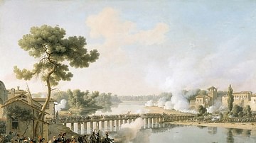
Battle of Lodi
The Battle of Lodi (10 May 1796) was a minor, yet important, engagement during Napoleon's Italian Campaign of 1796-97. Although the battle itself held little military significance, victory at Lodi gave General Napoleon Bonaparte the respect...

Worksheet/Activity
Romans vs. Carthaginians - Text & Labelling
This activity has been designed to fit a 20-30-minute slot for your class and is suitable for both online and classroom teaching, as well as homeschooling. Students have to label the illustrations of Roman and Carthaginian soldiers, based...

Article
Give Me Liberty or Give Me Death
"Give me liberty or give me death!” is the closing line from a speech made by Patrick Henry to the Second Virginia Convention on 23 March 1775, in which he argued that war with Britain was inevitable and a militia should be raised to defend...

Article
Roman Games, Chariot Races & Spectacle
If there was one thing the Roman people loved it was spectacle and the opportunity of escapism offered by weird and wonderful public shows which assaulted the senses and ratcheted up the emotions. Roman rulers knew this well and so to increase...

Article
Parthia: Rome's Ablest Competitor
As a superpower in its own right and in competition with Rome, Parthia's empire - ruling from 247 BCE to 224 CE - stretched between the Mediterranean in the west to India in the east. Not only did the Parthians win battles against Rome they...

Definition
Persian Wars
The Persian Wars refers to the conflict between Greece and Persia in the 5th century BCE which involved two invasions by the latter in 490 and 480 BCE. Several of the most famous and significant battles in history were fought during the Wars...

Definition
Battle of Thermopylae
Thermopylae is a mountain pass near the sea in northern Greece which was the site of several battles in antiquity, the most famous being that between Persians and Greeks in August 480 BCE. Despite being greatly inferior in numbers, the Greeks...

Definition
Samurai
The samurai (also bushi) were a class of warriors that arose in the 10th century in Japan and which performed military service until the 19th century. Elite and highly-trained soldiers adept at using both the bow and sword, the samurai were...

Definition
Punic Wars
The Punic Wars were a series of conflicts fought between Carthage and Rome between 264 BCE and 146 BCE. The name Punic comes from the word Phoenician (Phoinix in the Greek, Poenus from Punicus in Latin) as applied to the citizens of Carthage...