
Search
Remove Ads
Advertisement
Search Results
Image
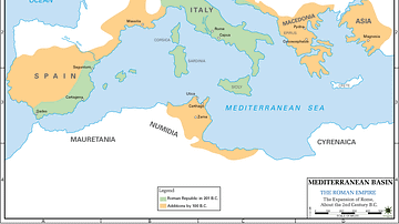
Map of 2nd Century Roman Expansion
A map showing the early expansions of Rome, in the 2nd century BC.
Image
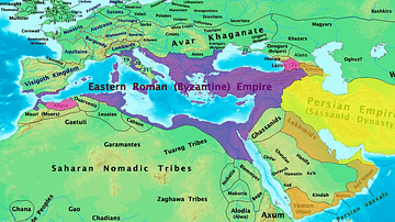
Byzantine & Persian Empires in the 7th Century
A map showing the extent of the Byzantine Empire and the Sasanian Empire in the 7th century.

Image
17th-century Depiction of Plague Doctor
A depiction of "Doctor Schnabel" ("Schnabel" is literally German for "Beak"), a plague doctor in Rome. The illustration appeared in a 17th -century German satirical manuscript. The engraving was first published by Paul Fürst (1608–1666...
Image
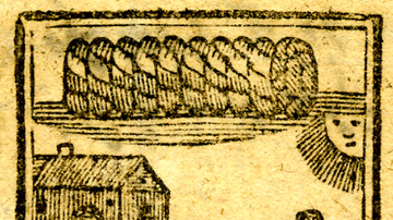
18th-Century Advertisement for Virginia Tobacco
An 18th-century woodcut advertisement for Virginia tobacco. The image shows child slaves working on a tobacco plantation. (British Museum, London)
Image
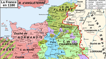
Map of 12th-Century France
A map showing the various counties and duchies of France at the end of the 12th century.

Image
Family Tree of the Royal Dynasty of Macedon in the 4th Century BCE
Family tree of the Royal Dynasty of Macedon in the 4th Century BCE. From Unearthing the Family of Alexander the Great. Grant (2019) p76. Used with permission from Pen & Sword Books.

Image
Map of the Hellenic Leagues and Hegemonies, 4th century BCE
The political landscape of the Hellenic world shifted dramatically in the aftermath of the Peloponnesian War (431–404 BCE), a conflict that ended with Sparta’s victory but left the Greek city-states militarily exhausted and politically fragmented...

Image
Map of the Early Christian Pilgrimage (4th-5th Century)
The rise of Christian pilgrimage begins after the conversion of Emperor Constantine (reign 306–337 CE) and the legalization of Christianity in the Edict of Milan (313 CE). The word pilgrim comes from the Latin peregrinus meaning “stranger”...
Image
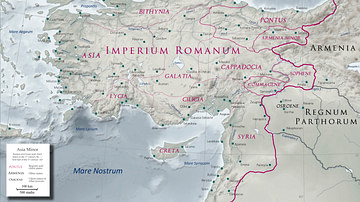
Asia Minor in the Early 1st Century CE
Map of Asia Minor in the early 1st century CE with the Kingdom of Commagene as a Roman client state.
Image
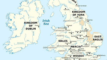
British Isles at the Beginning of the 10th Century
British Isles in 10th century represented with the coastline at the time.