
Search
Remove Ads
Advertisement
Search Results

Image
18th-century Mughal Miniature Quran
A miniature Qur'an in vellum binding. Mughal Empire, 18th century. (Victoria and Albert Museum, London)
Image
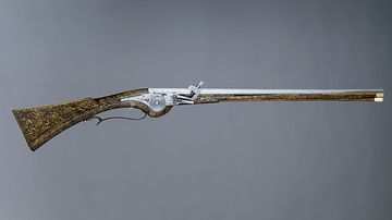
17th-Century Wheellock Carbine
A French 17th-century wheellock carbine. This type of weapon was typically used by cavalrymen, for example, during the English Civil Wars. (1642-51). This example is particularly ornate since it was possibly made for Louis XIII of France...
Image
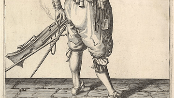
17th-century Musketeer Loading His Weapon
An illustration of a 17th-century musketeer loading his weapon. From a series of engravings in a Dutch 1608 arms manual The Exercise of Arms. (Metropolitan Museum of Art, New York)
Image
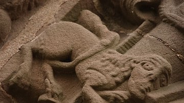
Manticore at the Church of St Mary and St David, Kilpeck, Herefordshire (12th century)
Kilpeck church stone carvings: Manticore. Dating to the 12th century and found at the Church of St Mary and St David in Herefordshire, England.

Image
Monte Cassino in the 15th Century
Illustration of Monte Cassino in the 15th-century Nuremberg Chronicle. Published in Nuremberg, Germany, 1493.

Image
Detail of a 6th-century Elephant Mosaic
Detail of a 6th-century mosaic floor that used to decorate the pavement of the peristyle court of the Palatium Magnum, the Great Palace of Constantinople. The Great Palace Mosaic Museum houses mosaics from the Byzantine period, unearthed...
Image
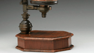
18th-Century Microscope
An early 18th-century microscope designed and made by John Marshall. It is a compound microscope, that is, it uses three lenses. Made of brass, wood, and other materials. (Science Museum, London)
Image
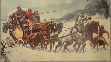
19th-Century Coach Caught in Snow
A picture of a 19th-century coach caught in the snow. From a tin produced by Excelvit. (Private Collection)
Image
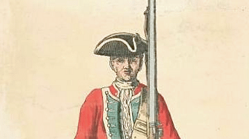
Mid-18th Century British Infantryman
An illustration of a mid-18th century British infantryman. 39th Regiment, 1742.

Image
20th-Century Sepoy
An early-20th-century painting by Major A.C. Lovett of a sepoy in the British Indian Army. (From The Armies of India, 1911)