As the Roman Republic transformed into an empire that encircled the entire Mediterranean and cities across the provinces undertook Roman government functions, they also developed distinctly Roman features such as a Roman forum, Roman baths, a theater or an amphitheater, and temples and sanctuaries dedicated to various deities.
The following gallery features 45 such administrative centers of the early Roman Empire.
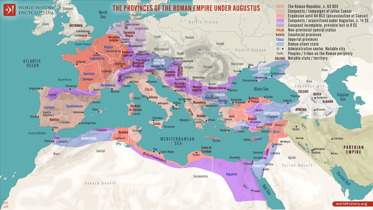
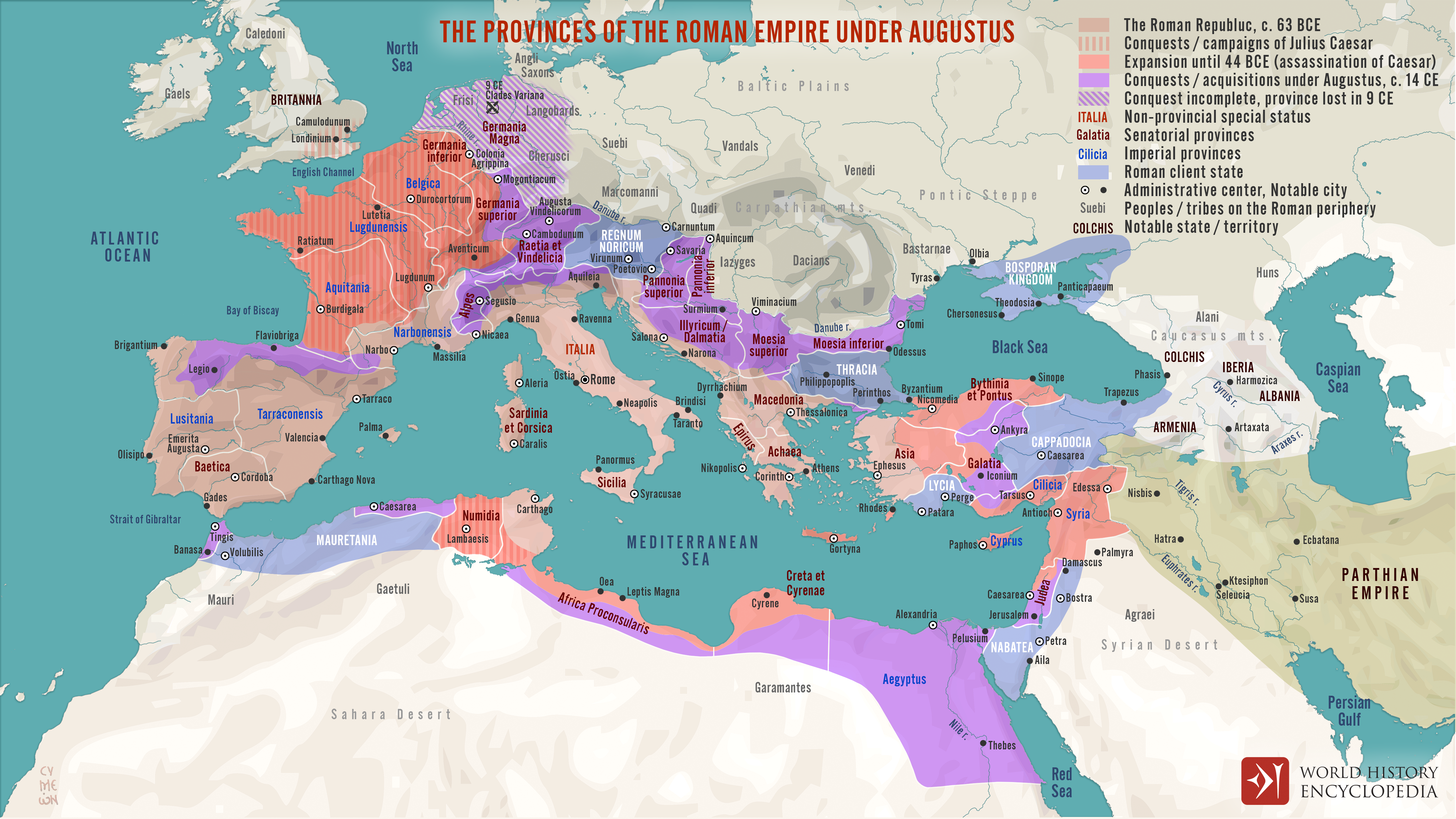
Map of the Provinces of the Roman Empire under Augustus
This map illustrates the expansion of the Roman Republic during the military campaigns and conquests of Julius Caesar (100–44 BCE), and its transformation into an empire under the reign of CaesarAugustus (63 BCE–14 CE), also known as Octavian. By the death of Augustus in 14 CE, the Roman world encircled the entire Mediterranean and extended from the North Sea to the Red Sea.
In addition to territorial expansion, the map also depicts the administrative structure of the Roman world at the time. It highlights the division between regions governed directly by the emperor, those administered by the Roman Senate, and others maintained as semi-independent client states. This layered system reflects the political complexity of the early Roman Empire and its blend of republican legacy with imperial authority.
Uploaded by Simeon Netchev, published on 24 March 2022. The copyright holder has published this content under the following license: Creative Commons Attribution-NonCommercial-NoDerivs. This licence only allows others to download this content and share it with others as long as the author is credited, but they can't change the content in any way or use it commercially. When republishing on the web a hyperlink back to the original content source URL must be included. Please note that content linked from this page may have different licensing terms.


