

Map of Roman North Africa (146 BCE - 395 CE)

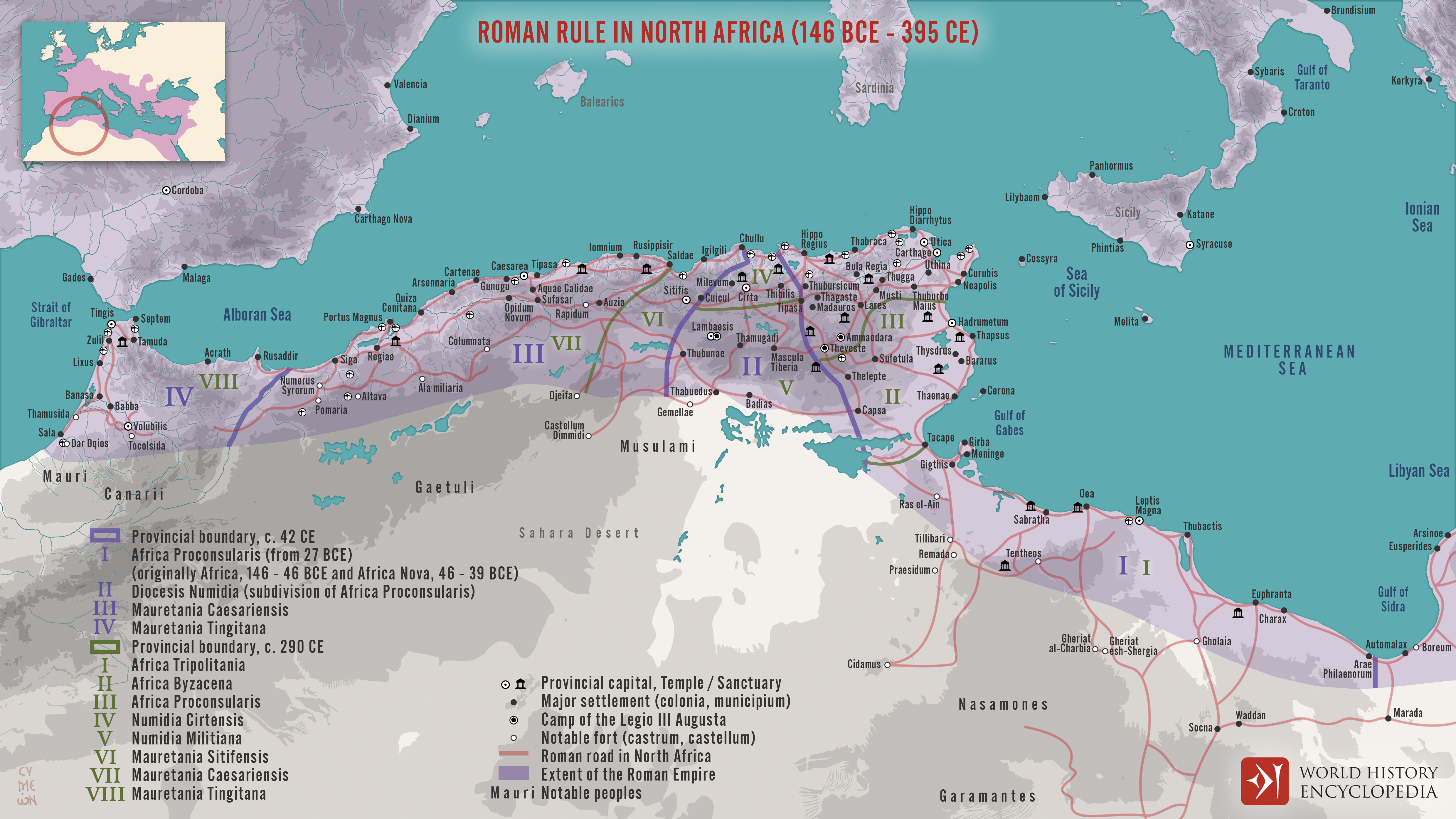
This map illustrates the scope and administrative organization of the Roman provinces in North Africa, from the initial conquest in 146 BCE to their full integration into the empire. Following the destruction of Carthage at the end of the Third Punic War, Rome began establishing provinces across the Maghreb, shaping a region that would become central to the empire’s economy and stability.
From the formation of Africa Proconsularis (in what is now Tunisia and western Libya) to the later provinces of Mauretania Caesariensis and Mauretania Tingitana (in modern Algeria and Morocco), Roman North Africa flourished between the 2nd century BCE and the 4th century CE. Rich in grain, olive oil, and trade wealth, these provinces were among the most productive in the empire. The map also reflects the layered provincial governance system—ranging from senatorial provinces to imperial territories—highlighting Rome’s sophisticated approach to managing distant yet economically vital lands.