


The Roman provinces in Hispania (206 BCE–c. 474 CE) illustrate both the persistence of Roman expansion and the durability of imperial rule. The conquest began in the Second Punic War, when Rome displaced Carthage in 206 BCE, and unfolded over nearly two centuries as legions subdued Iberian and Celtiberian peoples. By the reign of Augustus (27 BCE–14 CE), the peninsula was reorganized into formal provinces, with Hispania Tarraconensis, Baetica, and Lusitania forming the core. These regions supplied the empire with silver, gold, olive oil, and grain, while also serving as a recruiting ground for Roman armies.
Over the following five centuries, Hispania became one of the most thoroughly Romanized areas of the West. Cities like Emerita Augusta (Mérida), Italica, and Tarraco flourished with theaters, aqueducts, and forums, while Latin language, Roman law, and Christianity took deep root. Hispania produced notable emperors, including Trajan (98–117 CE) and Hadrian (117–138 CE). Even as the Western Empire crumbled in the 5th century, northeastern Hispania remained under nominal Roman control until c. 474 CE, outlasting many other provinces and leaving a legacy of cultural and institutional continuity that shaped medieval Iberia.
About the Author

Related Images

Map of the Travels of Hadrian & the Roman Empire c. 125 CE
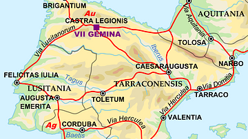
Map of the Iberian Penninsula in 125 AD

The Journey of Hadrian 121-125 CE - An Emperor on the Move: Defense and Diplomacy in the Roman World

The Iberian Peninsula, c. 1000 CE

Map of the Roman Empire in 125 CE
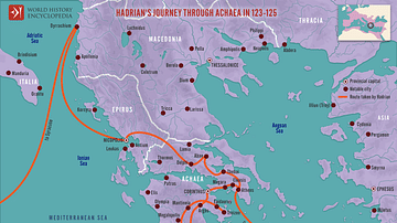
Hadrian's Journey through Achaea, 123-125
Cite This Work
APA Style
Netchev, S. (2023, February 01). Map of Roman Hispania c. 125 CE. World History Encyclopedia. https://www.worldhistory.org/image/16928/map-of-roman-hispania-c-125-ce/
Chicago Style
Netchev, Simeon. "Map of Roman Hispania c. 125 CE." World History Encyclopedia, February 01, 2023. https://www.worldhistory.org/image/16928/map-of-roman-hispania-c-125-ce/.
MLA Style
Netchev, Simeon. "Map of Roman Hispania c. 125 CE." World History Encyclopedia, 01 Feb 2023, https://www.worldhistory.org/image/16928/map-of-roman-hispania-c-125-ce/.