

Map of the Indus Valley Civilization, c. 3300-1300 BCE


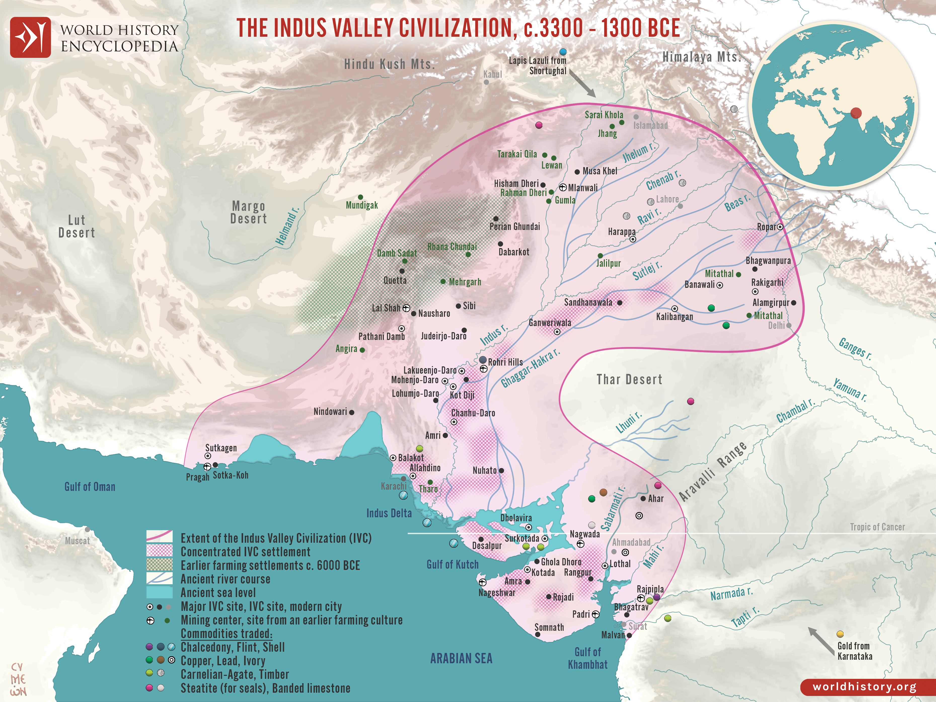
The Indus Valley Civilization (c. 3300–1300 BCE) was one of the earliest complex societies of the Bronze Age world, extending across parts of present-day Pakistan and northwestern India. Its most developed phase, often called the Mature Harappan period (c. 2600–1900 BCE), saw the emergence of large, carefully planned urban centers integrated within a wide regional network. Major cities such as Harappa and Mohenjo-daro demonstrate sophisticated civic organization, with grid-based street layouts, standardized brick construction, and extensive drainage systems. These settlements formed part of a broader system of towns, craft centers, and trade nodes that connected the Indus region with neighboring cultural spheres.
Archaeological evidence indicates that Indus communities participated in long-distance exchange networks linking South Asia with regions such as Mesopotamia, where Indus merchants were known as traders from “Meluhha.” Despite their urban scale and economic reach, Indus cities show little clear evidence of monumental palaces or royal tombs, suggesting forms of governance that differed from the more visibly hierarchical systems of contemporary civilizations. After c. 1900 BCE the major urban centers gradually declined, and by c. 1300 BCE the urban phase had largely disappeared. Scholars commonly associate this transformation with environmental change, shifting river systems, and the reorganization of regional trade networks rather than a single catastrophic event.
Questions & Answers
When did the Indus Valley Civilization flourish?
- The Indus Valley Civilization flourished between c. 7000 and c. 600 BCE, although evidence of human activity in the region goes back much farther.
What are the two best-known cities of the Indus Valley Civilization?
- The two best-known cities of the Indus Valley Civilization are Harappa and Mohenjo-daro.
When was the Indus Valley Civilization discovered?
- The Indus Valley Civilization was discovered in 1829.
Has the script of the Indus Valley Civilization been deciphered?
- No. The Indus Script (also known as Harappan Script) has not been deciphered. All that is known of the culture comes from the ruins of the cities and artifacts found there.