
Browse Content
Image
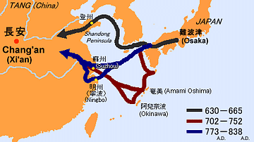
Sea Routes from Ancient Japan to China
A map illustrating possible sea routes used for political and cultural...
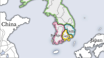
Image
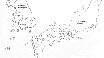
The Korean Peninsula and the Japanese Archipelago, 3rd-6th century CE
Map of Pen/Insular states and potential centres in the 3rd–6th...
Image
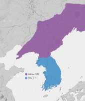
Unified Silla & Balhae Kingdoms
A map showing the territory of the Unified Silla Kingdom (668-...
Image
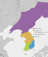
Later Three Kingdoms Period
A map showing the political geography of Korea during the Later...
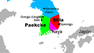
Image
Three Kingdoms of Korea Map
A map showing the three kingdoms (Goguryeo, Silla, and Baekje...
Image
Three Kingdoms, Korea
A map showing the Three kingdoms of ancient Korea (57 BCE - 668...