
Search
Search Results
Image
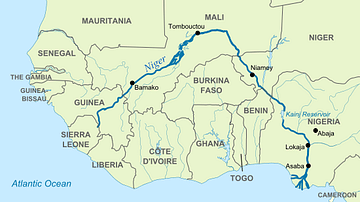
Map of Niger River
The Niger River is the most important river in West Africa, and is the third longest river in Africa after the Nile River and Congo River. Known for its distinctive "boomerang" shape, the Niger River flows from the Guinea Highlands to the...
Image
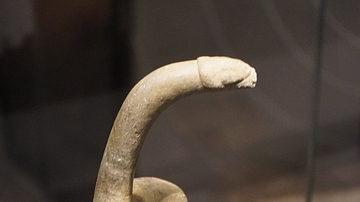
Bird Shaped Pestle
A bird-shaped pestle. Stone, 6000-2000 BCE. Oro Province, Papua New Guinea. Most modern vegetables and cereals were first cultivated around 10,000 years ago. This pestle was made for grinding taro, one of the crops farmers in Papua New...
Article
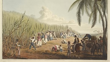
Slavery in Plantation Agriculture
The first plantations in the Americas of sugar cane, cocoa, tobacco, and cotton were maintained and harvested by African slaves controlled by European masters. When African slavery was largely abolished in the mid-1800s, the center of plantation...
Article
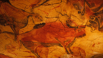
The Meaning of European Upper Paleolithic Rock Art
Rock art (also known as parietal art) is an umbrella term which refers to several types of creations including finger markings left on soft surfaces, bas-relief sculptures, engraved figures and symbols, and paintings onto a rock surface...

Video
The Dark History of Zombies - Christopher M. Moreman
Trace the origins of zombies from the Afro-Haitian religion of vodou, and discover how zombification was a reflection of slavery. – Zombies have a distinct lineage— one that traces back to Equatorial and Central Africa. For three centuries...

Image
Map Showing William Dampier's 1699 Expedition Route
Map showing William Dampier's expedition along the west and northwest coast of New Holland (Australia) and the coasts of Timor, New Guinea and New Britain in 1699 aboard the HMS Roebuck.
Image
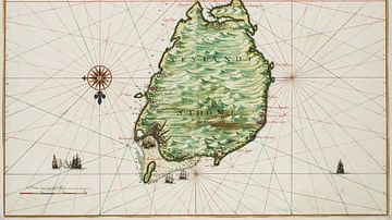
Historical Map of São Tomé
A 1665 map drawn by Johannes Vingboons of the island of São Tomé in the Gulf of Guinea in West Africa. The island was a Portuguese colony from c. 1486 to 1975. (National Archives of the Netherlands)
Image
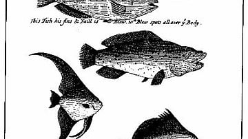
An Illustration from 'A Continuation of a Voyage to New Holland' by William Dampier.
Illustrations of fish off the coast of New Guinea in William Dampier's (1651-1715) book, A Continuation of a Voyage to New Holland.
Image
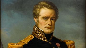
Dumont d'Urville
Jules Sébastien César Dumont d'Urville (1790-1842) was born at Condé sur Noireau, Normandy, France. He was a French explorer and navigator who made three voyages of discovery to Aotearoa New Zealand between 1827 and 1840. Dumont d'Urville...
Image
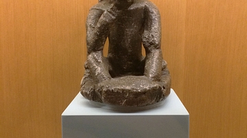
Seated Figure by Sape Artist
This is a seated figure by a Sape artist who lived in what is now present-day Sierra Leone or Guinea. It is made from soapstone with applied coating and dates from perhaps 1400-1500 CE. (Art Gallery of Ontario, Toronto)