


A map of Sicily in the early Bronze Age (2169 ±120 BCE - c.1500 BCE) divided into 4 cultural macro-regions: northern Sicily with the Rodì-Tindari-Vallelunga culture, western with the Naro/Partanna culture, the south-east with the Castelluccio culture and Capo Graziano culture at the Aeolian Islands.
About the Author

Related Images
Early Bronze Age Bell Beakers from Iberia
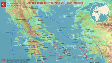
Map of the Aegean Bronze Age Civilizations, c. 3000-1100 BCE - From Minoan Maritime Exchange to Mycenaean Dominance

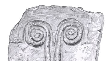
Prince's Tomb (Cava Lazzaro, Ragusa, Sicily)
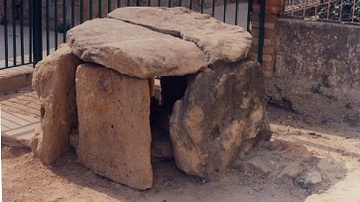
Dolmenic Cyst of Butera (Sicily)

Map of the Late Bronze Age Collapse and Transfromation - Interconnected political, economic & environmental breakdown
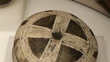
Tombstone Door (Castelluccio Culture, Sicily)
Cite This Work
APA Style
Piccolo, S. (2018, February 08). Sicily in the Early Bronze Age. World History Encyclopedia. https://www.worldhistory.org/image/8072/sicily-in-the-early-bronze-age/
Chicago Style
Piccolo, Salvatore. "Sicily in the Early Bronze Age." World History Encyclopedia, February 08, 2018. https://www.worldhistory.org/image/8072/sicily-in-the-early-bronze-age/.
MLA Style
Piccolo, Salvatore. "Sicily in the Early Bronze Age." World History Encyclopedia, 08 Feb 2018, https://www.worldhistory.org/image/8072/sicily-in-the-early-bronze-age/.