


Inscribed stone boundary marker from Chalkidiki, c.350 to 300 BCE.
Archaeological Museum of Thessalonika.
It is an example of ancient Greek boundary markers, known as horoi, and it contains an official declaration regarding the new Macedonian territories in the northern part of the Chalkidiki Peninsula in Central Macedonia, Greece. The second half of the 4th century BCE was a period marked by significant Greco-Macedonian conflicts and important historical events. In 349 BCE, Philip II of Macedon invaded the region as part of his efforts to conquer Greece, defeating the Chalkidian League and destroying the city of Olynthus. After Philip’s assassination in 336 BCE, his son, Alexander the Great, continued his expansion, though mostly abroad. Following the unexpected death of Alexander the Great in 323 BCE, a series of intense struggles over succession, known as the Wars of Diadochi, ensued. Around 310 BCE, Cassander, a claimant to the throne who had married Alexander’s sister, Thessalonike of Macedon, eliminated the remaining members of the Argead royal family and became King of Macedonia. He also founded the cities of Kassandreia and Thessaloniki in the Chalkidiki region.
In this historical context, the Chalkidikian horos is likely an official decree issued by the new Macedonian authority after Philip II’s conquest, marking the boundaries of the newly annexed territories. Although only partially preserved, the inscription outlines typical geographic markers, such as water sources (rivers Ammites and Manes), mountains (possibly the modern Vermio Mountains, identified as the Hermaion), place names (including Heptadryon, Prinos, and Lefki Petra), as well as religious sites (e.g., sanctuaries of the Dioskouri and Artemis), major roads, and private properties. The inscription was discovered near Mount Cholomon, northeast of Polygyros in Central Macedonia, Greece.
About the Author

Photo Location
This photograph was taken at the following location:
Related Images

Cassander
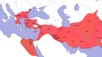
Diadochi Satraps 323 BCE
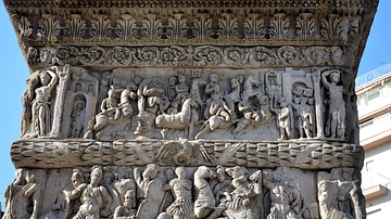
Relief Scenes, Arch of Galerius, Thessalonica
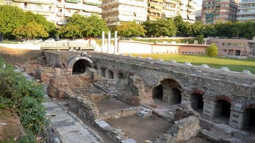
Roman Forum, Thessalonica
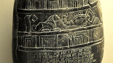
Boundary Stone from Mesopotamia

Gezer Boundary Stone
Cite This Work
APA Style
Choubineh, N. (2025, July 11). Boundary Marker with an Official Inscription from Chalkidiki. World History Encyclopedia. https://www.worldhistory.org/image/20678/boundary-marker-with-an-official-inscription-from/
Chicago Style
Choubineh, Nathalie. "Boundary Marker with an Official Inscription from Chalkidiki." World History Encyclopedia, July 11, 2025. https://www.worldhistory.org/image/20678/boundary-marker-with-an-official-inscription-from/.
MLA Style
Choubineh, Nathalie. "Boundary Marker with an Official Inscription from Chalkidiki." World History Encyclopedia, 11 Jul 2025, https://www.worldhistory.org/image/20678/boundary-marker-with-an-official-inscription-from/.