
Server Costs Fundraiser 2026


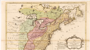
Walkway map at the Cherokee Removal Park, Meigs County, Tennessee, USA, depicting the routes of the Cherokee on the Trail of Tears.
Related Images

Map of the European Colonization of North America, 1492-1750

Map of Spanish Conquest & Exploration in North America

Map of Celtic Peoples in the Post-Classical Period

Map of Westward Exploration and Settlement of the USA c.1855

North America in the French and Indian War 1754–1763 - A Colonial War and the Roots of American Revolution
English & French Colonies in North America, 1758 CE
Cite This Work
APA Style
Believe, I. O. M. (2025, February 25). Walkway map at the Cherokee Removal Memorial Park. World History Encyclopedia. https://www.worldhistory.org/image/20079/walkway-map-at-the-cherokee-removal-memorial-park/
Chicago Style
Believe, It's Only Make. "Walkway map at the Cherokee Removal Memorial Park." World History Encyclopedia, February 25, 2025. https://www.worldhistory.org/image/20079/walkway-map-at-the-cherokee-removal-memorial-park/.
MLA Style
Believe, It's Only Make. "Walkway map at the Cherokee Removal Memorial Park." World History Encyclopedia, 25 Feb 2025, https://www.worldhistory.org/image/20079/walkway-map-at-the-cherokee-removal-memorial-park/.