
Server Costs Fundraiser 2026


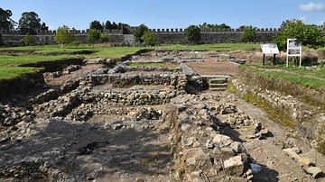
Aerial view of the Roman fort Apsarus, located in western Georgia, 15 kilometres (9.3 mi) south of Batumi near the Turkish border. Established on the left bank of the mouth of the Chorokhi River in the 1st century under Roman emperor Nero (r. 54-68 CE), Apsarus was the largest Roman stronghold along the Colchian littoral (the Pontus Limes). Arrian inspected the fort in the early 130s and recorded the presence of five cohorts (approximately 1,200-1,500 men).
Related Images
Remains of the Apsarus Roman Fort
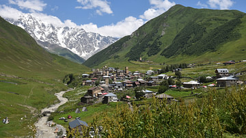
View of the Caucasus Mountains in Svaneti, Georgia

Aerial View of Trenches, Western Front in 1916

Aerial View, Chateau de Chambord

Aerial View of Auschwitz

Aerial View of the Suez Canal
Cite This Work
APA Style
კოლხი. (2023, November 27). Aerial view of the Roman Fort of Apsarus. World History Encyclopedia. https://www.worldhistory.org/image/18190/aerial-view-of-the-roman-fort-of-apsarus/
Chicago Style
კოლხი. "Aerial view of the Roman Fort of Apsarus." World History Encyclopedia, November 27, 2023. https://www.worldhistory.org/image/18190/aerial-view-of-the-roman-fort-of-apsarus/.
MLA Style
კოლხი. "Aerial view of the Roman Fort of Apsarus." World History Encyclopedia, 27 Nov 2023, https://www.worldhistory.org/image/18190/aerial-view-of-the-roman-fort-of-apsarus/.