


The travels of Edmond Halley (1656–1742) illustrate how the Scientific Revolution increasingly joined theoretical knowledge with observation, measurement, and exploration. Working within the expanding maritime world of late 17th-century England, Halley travelled across Europe and the Atlantic to study astronomy, navigation, tides, winds, and Earth's magnetic field. His observations from Saint Helena between 1676 and 1678 produced an important catalogue of southern stars and helped secure his election to the Royal Society at only 22.
Halley later carried scientific investigation directly to sea. As captain of HMS Paramour between 1698 and 1700, he crossed much of the Atlantic measuring magnetic declination, the difference between magnetic north and true north, in an effort to improve navigation and the determination of longitude. His voyages helped produce pioneering magnetic charts and demonstrate a broader transformation in European science: knowledge increasingly depended on systematic observation, specialized instruments, state and institutional support, and the collection of data across the wider world.
About the Author
Related Images
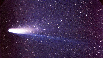
Halley's Comet
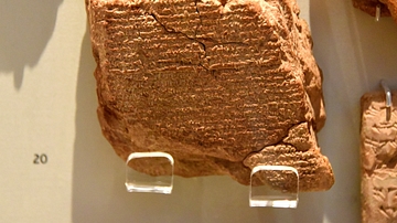
Tablet Observation of Halley's Comet

The Scientific Revolution (c. 1500–1700) - From Tradition to Empiricism in Early Modern Europe

Bust of Edmond Halley

Edmond Halley by Murray

Magnetic Sea Chart by Halley
Cite This Work
APA Style
Netchev, S. (2026, October 05). Map of Edmond Halley’s Scientific Voyages: Exploration, Astronomy & Navigation, 1676–1703. World History Encyclopedia. https://www.worldhistory.org/image/18164/map-of-edmond-halleys-scientific-voyages/
Chicago Style
Netchev, Simeon. "Map of Edmond Halley’s Scientific Voyages: Exploration, Astronomy & Navigation, 1676–1703." World History Encyclopedia, October 05, 2026. https://www.worldhistory.org/image/18164/map-of-edmond-halleys-scientific-voyages/.
MLA Style
Netchev, Simeon. "Map of Edmond Halley’s Scientific Voyages: Exploration, Astronomy & Navigation, 1676–1703." World History Encyclopedia, 05 Oct 2026, https://www.worldhistory.org/image/18164/map-of-edmond-halleys-scientific-voyages/.
