
Illustration


This map illustrates the travels of the English scientist Edmond Halley (1656–1742), a pioneering astronomer, mathematician, and geophysicist, whose journeys during the late 17th and early 18th centuries advanced navigation, astronomy, and Earth sciences. His voyages took him from the remote southern skies of Saint Helena to the coasts of Europe and the Atlantic Ocean.
Halley’s early observations of southern constellations on Saint Helena (1676–1678) earned him renown at just 22 years old. He later tracked the Great Comet of 1680 across Europe and correctly predicted the periodic return of what would become Halley’s Comet. As captain of the HMS Paramour—a ship designed for scientific research—he conducted the first magnetic survey of the Atlantic and explored tidal patterns in the English Channel. These expeditions laid key groundwork in understanding terrestrial magnetism, weather systems, and celestial motion.
About the Author

Related Images

Magnetic Sea Chart by Halley

Halley's Comet
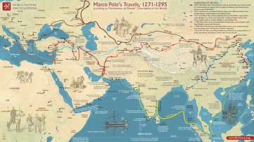
Map of Marco Polo’s Travels, 1271 - 1295
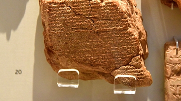
Tablet Observation of Halley's Comet

Map of the Trade in the Indian Ocean 15th-16th century
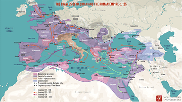
The Travels of Hadrian and the Roman Empire c. 125 CE
Cite This Work
APA Style
Netchev, S. (2023, November 21). Map of Edmond Halley’s Travels. World History Encyclopedia. Retrieved from https://www.worldhistory.org/image/18164/map-of-edmond-halleys-travels/
Chicago Style
Netchev, Simeon. "Map of Edmond Halley’s Travels." World History Encyclopedia. Last modified November 21, 2023. https://www.worldhistory.org/image/18164/map-of-edmond-halleys-travels/.
MLA Style
Netchev, Simeon. "Map of Edmond Halley’s Travels." World History Encyclopedia. World History Encyclopedia, 21 Nov 2023, https://www.worldhistory.org/image/18164/map-of-edmond-halleys-travels/. Web. 01 Jul 2025.