Server Costs Fundraiser 2024
Illustration
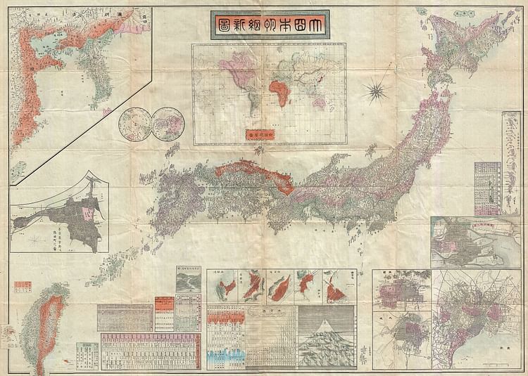
Map of the Japanese Empire, 1895. It was issued shortly after the 1895 Japanese invasion of Taiwan and is consequently one of the first Japanese maps to include Taiwan and Korea as provinces of Imperial Japan.
Geographicus Rare Antique Maps.
Cite This Work
APA Style
Maps, G. R. A. (2022, October 19). Map of the Japanese Empire, 1895. World History Encyclopedia. Retrieved from https://www.worldhistory.org/image/16571/map-of-the-japanese-empire-1895/
Chicago Style
Maps, Geographicus Rare Antique. "Map of the Japanese Empire, 1895." World History Encyclopedia. Last modified October 19, 2022. https://www.worldhistory.org/image/16571/map-of-the-japanese-empire-1895/.
MLA Style
Maps, Geographicus Rare Antique. "Map of the Japanese Empire, 1895." World History Encyclopedia. World History Encyclopedia, 19 Oct 2022. Web. 27 Jul 2024.


