Server Costs Fundraiser 2024
Illustration
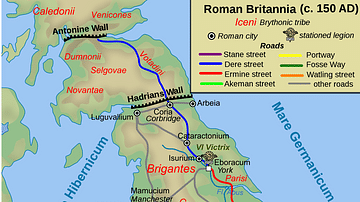
A map illustrating the span, structure, and context of the 73 miles (118 km) Hadrian's Wall (also called the Vallum Aelii, Aelius being the family name of emperor Hadrian). Built by a force of more than 15,000 soldiers from the three Roman legions stationed in Britain, with an intent "to separate the Romans from the barbarians" (the Picts and other tribes to the north of Britain), the wall defined the northern frontier of the Roman Empire along the Tyne–Solway isthmus and created a military zone full of forts, milecastles, ramparts, roads, barracks and bustling settlements from the North Sea to the Irish Sea.
About the Author
Cite This Work
APA Style
Netchev, S. (2022, August 25). Vallum Hadriani (Hadrian’s wall), c. 122 CE. World History Encyclopedia. Retrieved from https://www.worldhistory.org/image/16294/vallum-hadriani-hadrians-wall-c-122-ce/
Chicago Style
Netchev, Simeon. "Vallum Hadriani (Hadrian’s wall), c. 122 CE." World History Encyclopedia. Last modified August 25, 2022. https://www.worldhistory.org/image/16294/vallum-hadriani-hadrians-wall-c-122-ce/.
MLA Style
Netchev, Simeon. "Vallum Hadriani (Hadrian’s wall), c. 122 CE." World History Encyclopedia. World History Encyclopedia, 25 Aug 2022. Web. 26 Jul 2024.


