


The political fragmentation of al-Andalus began with the collapse of the Umayyad Caliphate of Córdoba (756–1031), culminating in its formal dissolution in 1031. In the power vacuum that followed, the Iberian Peninsula fractured into dozens of independent Muslim-ruled states known as taifas (from the Arabic ṭāʾifa, meaning “faction” or “party”). These taifa kingdoms, ruled by local dynasties of Arab, Berber, and Ṣaqāliba (Slavic-origin) elites, competed through warfare, diplomacy, and shifting alliances while attempting to preserve legitimacy and autonomy in an increasingly unstable political landscape.
At their height, there may have been up to fifty taifas, though power gradually concentrated in major centers such as Seville, Toledo, Zaragoza, Badajoz, Valencia, and Granada. Despite periods of cultural and economic prosperity, political division left the taifas vulnerable to external pressure, most notably from the expanding Christian kingdoms of the north. The capture of Toledo in 1085 by Alfonso VI of León and Castile (reign 1065–1109) marked a decisive turning point. Facing existential threat, several taifa rulers appealed to the Almoravids, a reformist Berber dynasty from North Africa, whose intervention led to the military defeat and eventual absorption of the taifas by c. 1090. This transition ended the first taifa period and ushered in a new phase of political centralization under external Islamic rule.
About the Author

Related Images

The Iberian Peninsula, c. 1000 CE

Map of North Africa and the Western Mediterranean c. 1065 - Power Shifts in the Post-Caliphate Maghreb

Map of the Rashidun Caliphate

Map of the Islamic Conquests in the 7th-9th Centuries
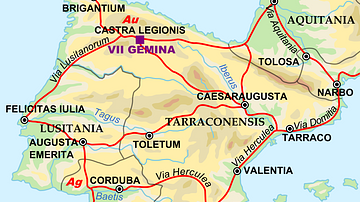
Map of the Iberian Penninsula in 125 AD

Rashidun Caliphate Under Caliph Abu Bakr
Cite This Work
APA Style
Netchev, S. (2025, December 27). Map of the Taifa Kingdoms of al-Andalus (c. 1031–1086): Iberian Peninsula on the Eve of the Almoravid Intervention. World History Encyclopedia. https://www.worldhistory.org/image/15872/map-of-the-taifa-kingdoms-of-al-andalus-c-1031-108/
Chicago Style
Netchev, Simeon. "Map of the Taifa Kingdoms of al-Andalus (c. 1031–1086): Iberian Peninsula on the Eve of the Almoravid Intervention." World History Encyclopedia, December 27, 2025. https://www.worldhistory.org/image/15872/map-of-the-taifa-kingdoms-of-al-andalus-c-1031-108/.
MLA Style
Netchev, Simeon. "Map of the Taifa Kingdoms of al-Andalus (c. 1031–1086): Iberian Peninsula on the Eve of the Almoravid Intervention." World History Encyclopedia, 27 Dec 2025, https://www.worldhistory.org/image/15872/map-of-the-taifa-kingdoms-of-al-andalus-c-1031-108/.