


Chart of Van Diemen's Land (Tasmania) by the British navigator and cartographer, Matthew Flinders, (1774-1814). Chart drawn 1798-1799.
Related Images
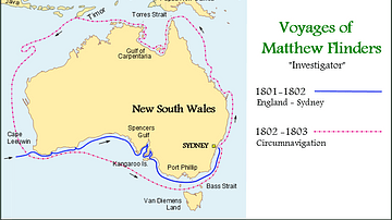
Map of the Voyages of Matthew Flinders in the Investigator

Matthew Flinders

Magnetic Sea Chart by Halley
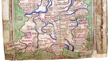
Matthew Paris' Map of Britain

Chart of the Malay Archipelago and the Dutch Discoveries in Australia
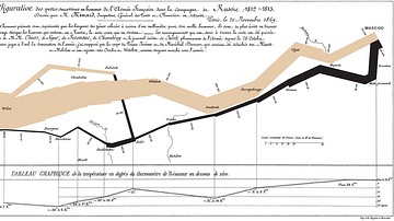
Chart Showing the Number of Men in Napoleon's Russian Campaign of 1812
Cite This Work
APA Style
London., N. M. M. G. (2021, December 31). Chart of Van Diemen's Land. World History Encyclopedia. https://www.worldhistory.org/image/15072/chart-of-van-diemens-land/
Chicago Style
London., National Maritime Museum, Greenwich,. "Chart of Van Diemen's Land." World History Encyclopedia, December 31, 2021. https://www.worldhistory.org/image/15072/chart-of-van-diemens-land/.
MLA Style
London., National Maritime Museum, Greenwich,. "Chart of Van Diemen's Land." World History Encyclopedia, 31 Dec 2021, https://www.worldhistory.org/image/15072/chart-of-van-diemens-land/.