
Search
Remove Ads
Advertisement
Search Results
Image
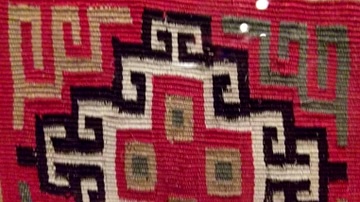
Inca Geometric Textile Motif
A detail from an Inca textile showing a geometric cross design. (Museo de America, Madrid)
Image
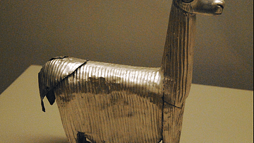
Inca Silver Alpaca
A silver alpaca from the Inca civilization of Peru, c. 1400 and 1533 CE. (American Museum of Natural history, New York)

Image
Inca Textile Bag
An Inca textile bag with typical tassle decoration. (Lombards Museum)
Image
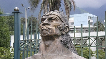
Inca General Ruminahui
Sculpture of Inca General Ruminahui (1490-1535 CE) in Quito, Ecuador.
Image
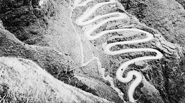
The Ledo Road
An aerial view of the Ledo Road in Burma (Myanmar), a land connection between India and China used by Allied troops during the Second World War (1939-45) following the closure of the more famous Burma Road. The road was in use from February...

Video
The Rise & Fall of the Inca Empire - Gordon McEwan
View full lesson: https://ed.ted.com/lessons/the-rise-and-fall-of-the-inca-empire-gordon-mcewan It was the western hemisphere's largest empire ever, with a population of nearly 10 million subjects. Yet within 100 years of its rise in the...
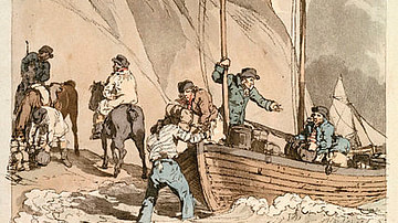
Image
Smugglers During the Continental System
Smugglers in 1808, defying the Continental System. Etching by John Augustus Atkinson and William Miller, 1808.
National Maritime Museum, Greenwich, London.

Image
Map of the Silk Road Routes
This map indicates trading routes used around the 1st century CE centred on the Silk Road. The routes remain largely valid for the period 500 BCE to 500 CE.
Image
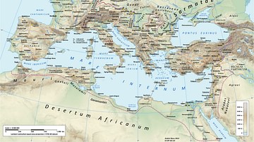
Roman Road Network
A map showing the principal routes of the Roman road network in 125 CE.

Image
Roman Road Surface
A section of a Roman road with a typical polygonal stone surface. The stones also show the ruts made by Roman wheeled vehicles. This section is beneath the Arco dei Gavi, a 1st century CE arch in Verona, Italy.