
Search
Remove Ads
Advertisement
Search Results
Image
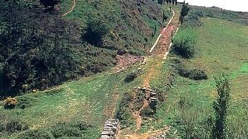
Roman Road, Spain
A section of surviving Roman road near Cirauqui in northern Spain. The curb stones can be clearly seen, a common feature of Roman roads.

Image
Inca Agricultural Terracing
An Inca circular terracing used to increase agricultural yield. Moray, Peru, 15-16th century CE.
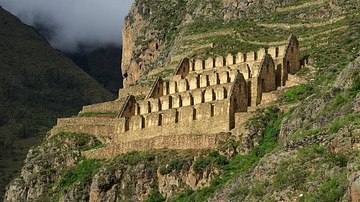
Image
Inca Qollqa
Inca qollqa (storehouses) used for storing grain and other foodstuffs. 15-16th century CE, Ollantaytambo.

Image
Inca Farmers
A colonial-era illustration depicting Inca farmers using traditional tools such as the foot plough. By the native chronicler Felipe Guaman Poma de Ayala, c. 1613 CE.
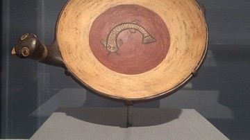
Image
Inca Bird-handled Dish
An Inca ceramic dish with a handle in the form of a bird. Peru, 1476-1534 CE. (St. Louis Art Museum, Missouri)

Definition
Ancient Persian Governors
The Achaemenid Persian Empire functioned as well as it did because of the efficient bureaucracy established by its founder Cyrus the Great (r. c. 550-530 BCE) which was administered through the satrapy system. A Persian governor of a province...
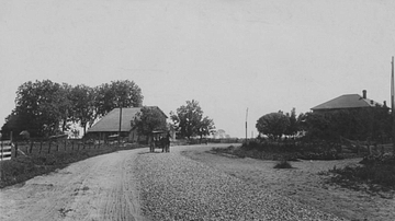
Image
Macadamised Road
A photograph of a macadamised road taken in the 1850s. The macadamised road, that is, a hard and relatively smooth road surface made using two layers of stones (one aggregate layer and a top layer of very small stones), was first made on...

Image
Pizarro Seizing the Inca of Peru
An 1846 painting by John Everett Millais titled "Pizarro Seizing the Inca of Peru". The scene shows the conquistador Francisco Pizarro (c. 1478-1541) capturing the Inca ruler Atahualpa at the battle of Cajamarca in 1533. (Victoria and Albert...
Article
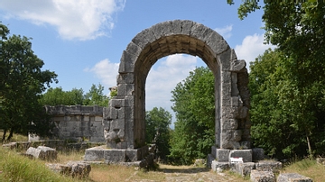
Visitor’s Guide to Carsulae (San Damiano)
Carsulae in Umbria, central Italy, was founded c. 300 BCE and only became a prosperous urban centre after it was connected by the Via Flaminia towards the end of the 3rd century BCE. It was granted the status of municipium and acquired a...
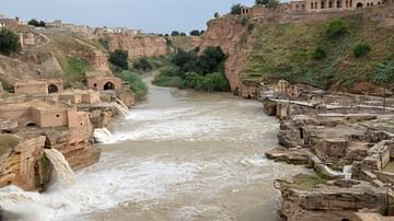
Image
Shushtar Hydraulic System, Iran
The Shushtar Hydraulic System is a Sasanian era (3rd century CE) water irrigation system in Shushtar in Iran that included watermills, dams, tunnels and canals. The mills, one of which is still functioning, were used to grind wheat and barley...