
Search
Remove Ads
Advertisement
Search Results

Image
Map of the ancient Near East during the Amarna Period
Map of the ancient Near East during the Amarna Period, showing the great powers of the period: Egypt (green), Hatti (yellow), the Kassite kingdom of Babylon (purple), Assyria (grey), and Mittani (red). Lighter areas show direct control, darker...
Image
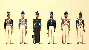
East India Company Madras Uniforms
A c. 1830 illustration by Yellapah of Vellore showing six Sepoy uniforms of the East India Company Madras army. From left to right: - Madras Horse Artillery - Madras Light Cavalry - Madras Rifle Corps - Madras Pioneers - Madras...
Image
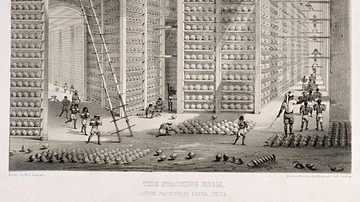
Opium Warehouse of the East India Company
A c. 1850 print showing an opium warehouse of the East India Company in Patna, India. Opium was dried into large balls and then packed into chests for transportation to China.

Image
East Asia in the year 1 CE
This map shows the boundaries of all major civilizations in East Asia at the beginning of the first millennium, with italics indicating nomadic bands and other tribal societies.
Image
East Asia in 400 CE
This map shows all major civilizations of East Asia at the beginning of 4th century CE. Italicized texts indicate nomadic bands or tribal societies.
Image
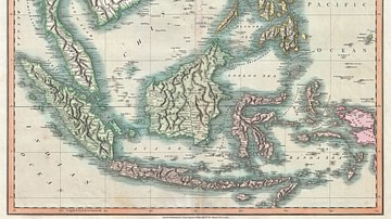
Map of the East Indies and Southeast Asia
An 1801 map of the East Indies and Southeast Asia ( Singapore, Borneo, Sumatra, Java, Philippines).
Image
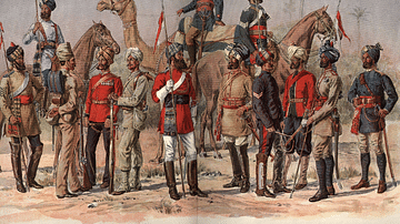
East India Company Madras Army
A 19th-century illustration showing officers and sepoys (Indian recruits) of the East India Company's Madras army.

Image
East Asia in 500 CE
This map shows the territories of all major civilizations in East Asia in the year 500 CE. Italicized texts indicate nomadic bands or tribal societies.
Image
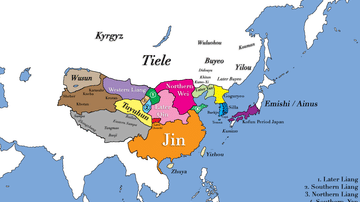
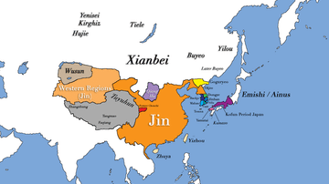
East Asia circa 300 CE
This map shows all major civilizations of East Asia at the beginning of the 3rd century CE. Italicized texts indicate nomadic bands or tribal societies.
Image
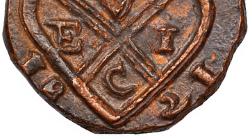
Copper Coin of the East India Company
A copper coin minted by the British East India Company (EIC). From Bombay, 1821.