
Search
Did you mean: Texcoco?
Remove Ads
Advertisement
Search Results

Image
Maya Ruins of San Gervasio on Cozumel
This photograph shows some Maya ruins from the San Gervasio archaeological site, which is located on the island of Cozumel in Mexico. In the center, one sees the "Niches" structure, which was once composed of...

Image
Sacred Maya Cenote at San Gervasio
This sacred Maya cenote or ceremonial sinkhole is located at the ruins of San Gervasio, which is located on the island of Cozumel in Mexico.

Image
Nayarit Cermaic House with Figures
This charming ceramic was made between 100 BCE-250 CE in Nayarit, Mexico. (Iris & B. Gerald Cantor Center for Visual Arts at Stanford University, Stanford, California)

Image
Viceroyalty of New Spain, c. 1800
This map illustrates the Viceroyalty of New Spain, the earliest and most extensive administrative division of the Spanish Empire. At its peak, it encompassed a vast array of territories across North America, the...
Image
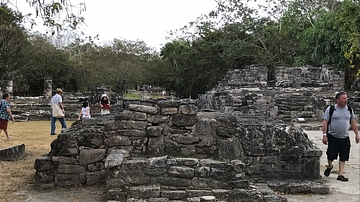
The Maya Altar at San Gervasio
This structure had a ceremonial use for the Maya people as it lies in the middle of the plaza at San Gervasio, which is located on the island of Cozumel, Mexico. It therefore must have served as a dais from which the...

Image
Map of The Olmec World and Its Mesoamerican Connections - Power, Resources, and Interaction Networks, c. 1500–400 BCE
The Olmec world developed in the tropical lowlands of present-day Veracruz and Tabasco during Mesoamerica’s Formative period (c. 1500–400 BCE). Major...

Image
Map of the United States Under the Compromise of 1850
This map illustrates the situation in the United States n 1850, as the country faced growing sectional tension over the expansion of slavery into new territories gained from the Mexican-American War...

Image
Map of the Mesoamerican Civilizations
The Mesoamerican civilizations represent a long continuum of complex societies that emerged independently in Central America and southern Mexico from roughly 1500 BCE to the early 16th century CE, prior to Spanish...

Image
Maya Tomb Structure at San Gervasio
This Maya building located on the island of Cozumel is named so due to the finding a vaulted tomb in its interior, unbique in San Gervasio, Mexico. The strcutre is a platform since it had no building on tiop of...

Image
The Maya "Palace" Structure at San Gervasio
Colonnaded halls were very popular among the Maya along Mexico's eastern coast in Pre-Columbian times. At San Gervasio, located on the Mexican island of Cozumel, one can see this Maya "palace" structure in...
