
Search
Remove Ads
Advertisement
Search Results

Article
Religion in the Middle Ages
Religion in the Middle Ages, though dominated by the Catholic Church, was far more varied than only orthodox Christianity. In the Early Middle Ages (c. 476-1000), long-established pagan beliefs and practices entwined with those of the new...
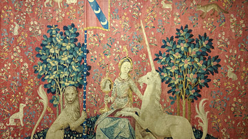
Image Gallery
The Lady and the Unicorn: Medieval Tapestries
The Lady and the Unicorn tapestries, housed at the Musée de Cluny in Paris, are a series of six exquisite medieval tapestries that are renowned for their beauty, craftsmanship, and mysterious symbolism. These tapestries are believed to have...
Collection
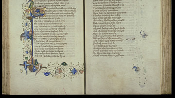
Medieval European Literature
Medieval literature developed in Europe from medieval folklore between c. 476 and c. 1500. The works ranged from poetry to drama, romance, prose, philosophical dialogues, and histories. Literary works were at first composed in Latin but...

Collection
Japan in Medieval Times
The history of medieval Japan (1185-1603 CE) involved the rise of the military and such figures as the shoguns and samurai but there were many other cultural developments in between and during the many wars that troubled the country. In this...

Article
Jesuit Influence on Post-medieval Chinese Astronomy
Ancient China had seen little Western contact before the 16th century CE, the language, culture and science all being allowed to develop independently of foreign influence. By the time European Jesuit missionaries arrived in the 16th century...

Collection
Daily Life in a Medieval Monastery
Monasteries and other religious institutions such as priories and nunneries were a quintessential part of the medieval landscape and an important component of a community's social fabric. Providing spiritual guidance, employment, education...

Image
Map of Europe After World War II (1945 to c. 1989)
In the aftermath of the Second World War (1939–1945), Europe emerged physically devastated and politically polarized. As Allied cooperation gave way to rivalry between the United States and the Soviet Union under Joseph Stalin (rule 1924–1953...

Definition
Knights Templar
The Knights Templar were established c. 1119 and given papal recognition in 1129. It was a Catholic medieval military order whose members combined martial prowess with a monastic life to defend Christian holy sites and pilgrims in the Middle...

Image
Map of the Migration Period in Europe in the 4th-5th Century
The Migration Period in Europe (c. 4th–6th centuries CE) marks a prolonged era of movement, conflict, and political transformation rather than a single moment of collapse. Following the death of Emperor Theodosius I (reign 379–395 CE) and...

Image Gallery
Reconstructions of Medieval Castles & Fortifications
This image gallery showcases several digital reconstructions of medieval castles, keeps and fortifications built throughout the Middle Ages. These defensive structures were built to ward off invaders and act as centres of government. Castles...