
Search
Remove Ads
Advertisement
Search Results
Image
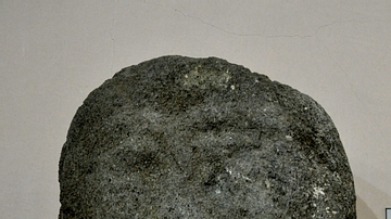
Head of a Bearded Man from the Musasir Kingdom
This is the upper part of a sandstone statue which was found near Rowanduz village, modern Sulaimaniya Governorate, Iraq. The lack of inscriptions on this statue make it difficult to determine who this...

Image
Map of the Kingdom of the Vandals (435–534 CE)
The Kingdom of the Vandals and Alans (435–534 CE) emerged as one of the most significant post-Roman states in the western Mediterranean. Founded after the Vandals, a Germanic people originally from Central...

Article
Great Female Rulers of Ancient Egypt
Women in ancient Egypt had more rights than in any other ancient culture and were valued with greater respect. This is evident not only in the physical evidence and inscriptions but in their religion. Some of the...

Image
Map of the New Kingdom of Egypt, 1450 BCE
A map showing the maximum territorial extent of the New Kingdom of Egypt, ca. 1450 BCE.

Image
Magadha Kingdom
A map showing the extent of the ancient kingdom of Magadha in India from the 6th to 4th century BCE.
Image
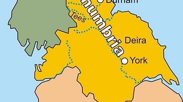
Map of the Kingdom of Northumbria
A map of the Kingdom of Northumbria (c. 604-954 CE) in the northeast of Britain c. 802 CE.

Image
Royal Sceptre, Kingdom of Kongo
A gold sceptre used by the kings of the Kingdom of Kongo (14-19th century CE). 17th century CE (?). (Royal Museum of Central Africa, Brussels, Belgium)
Image
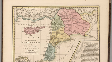
Kingdom of Jerusalem at the Time of the Crusades
This map depicts the Kingdom of Jerusalem (existed 1099-1291 CE), along with the Counties of Tripoli, Edessa, and Antioch.

Image
Map of Kingdom of Mercia
A map showing the greatest extent of the Kingdom of Mercia (c. 527-879 CE), an Anglo-Saxon political entity located in the midlands of present-day Britain

Image
Horned Mask, Luba Kingdom
A wooden horned mask of the Kingdom of Luba (15-19th century CE), central Africa. Height: 47 cm. (British Museum, London)
