
Search
Remove Ads
Advertisement
Search Results
Image
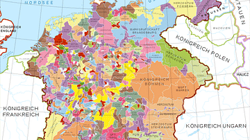
Holy Roman Empire in the 13th century CE
A map in German of central Europe during the time of the Hohenstaufen Emperors, primarily showing the territories of the Holy Roman Empire and the Kingdom of Sicily. The map is a vectorised version of this map from Professor G. Droysens...

Image
17th-Century Musketeer
A drawing of a typical 17th-century musketeer. Musketeers were a standard component of European infantry armies of the period and particularly during the English Civil Wars (1642-51). Ink and watercolours. Drawn in the 19th century. (British...

Image
Map of Japan in the 16th Century CE
A map of Japan during the Azuchi-Momoyama period (1568-1600 CE).

Image
Map of Viking Exploration, 8th-11th Century
This map illustrates the sweep of Viking exploration between the late 8th and early 11th centuries, charting longship routes from Scandinavia to the British Isles, Normandy, Iberia, Russia, the Mediterranean, and across the North Atlantic...
Image
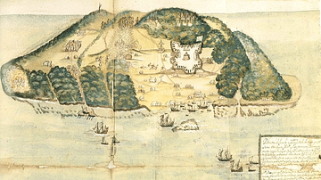
17th Century Tortuga
A 17th-century illustration of the buccaneer and pirate base of Tortuga, located on the northwest coast of Hispaniola (modern Haiti and the Dominican Republic).
Image
Map of 2nd Century Roman Expansion
A map showing the early expansions of Rome, in the 2nd century BC.
Image
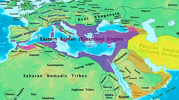
Byzantine & Persian Empires in the 7th Century
A map showing the extent of the Byzantine Empire and the Sasanian Empire in the 7th century.

Image
17th-century Depiction of Plague Doctor
A depiction of "Doctor Schnabel" ("Schnabel" is literally German for "Beak"), a plague doctor in Rome. The illustration appeared in a 17th -century German satirical manuscript. The engraving was first published by Paul Fürst (1608–1666...
Image
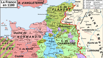
Map of 12th-Century France
A map showing the various counties and duchies of France at the end of the 12th century.

Image
Family Tree of the Royal Dynasty of Macedon in the 4th Century BCE
Family tree of the Royal Dynasty of Macedon in the 4th Century BCE. From Unearthing the Family of Alexander the Great. Grant (2019) p76. Used with permission from Pen & Sword Books.