

Map of Europe at the Peace of Westphalia, 1648

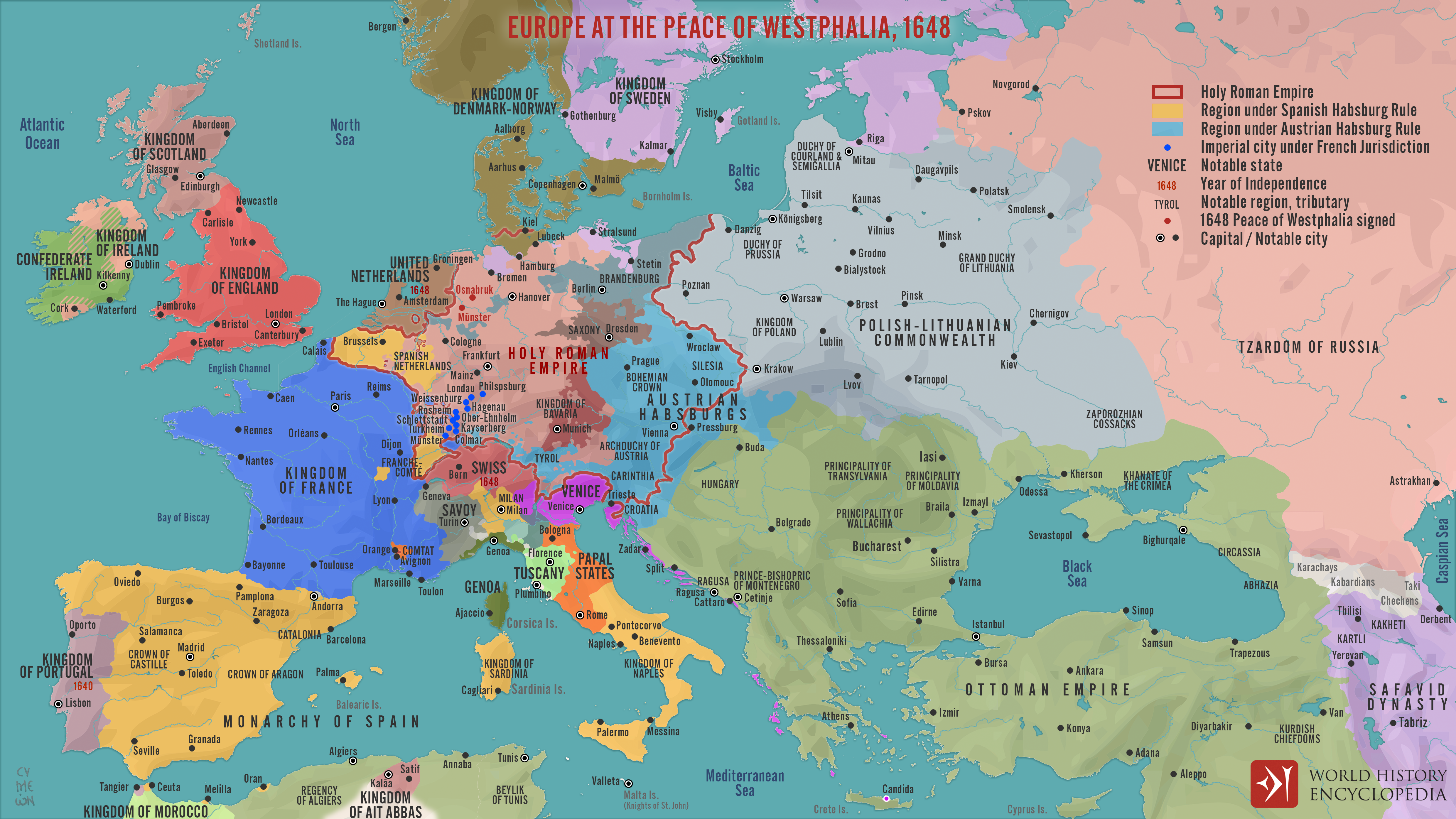
The Peace of Westphalia (1648), concluded through treaties signed at Osnabrück and Münster (May-October 1648), marked the end of two major conflicts: the Thirty Years’ War and the Eighty Years’ War. What began as a religious and dynastic struggle within the Holy Roman Empire evolved into a wider contest involving major European powers. The settlement formally recognized the independence of the Dutch Republic from Spanish Empire, and confirmed France and Sweden as key beneficiaries, shifting the balance of power away from Habsburg dominance.
Negotiated among more than one hundred delegations, the treaties restructured political authority within the empire by enhancing the autonomy of its constituent princes and cities, while limiting the universalist ambitions of the Habsburg emperors. The agreements reaffirmed and expanded earlier religious settlements, including recognition of Calvinism alongside Catholicism and Lutheranism, contributing to a more stable, though still contested, confessional order. Although not all European powers were directly represented, the Peace of Westphalia is often seen as a turning point in the development of interstate relations, reinforcing principles of territorial sovereignty, diplomatic negotiation, and legal equality among states that would shape European politics in the centuries that followed.