
Browse Content
Image
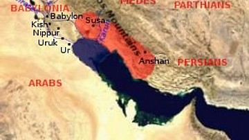
Elam Map
Map showing the area of the Elamite Empire (in red) and the neighboring...
Image
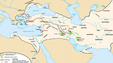
Achaemenid Empire Map
Map of the Persian Achaemenid Empire at its greatest extent under...
Image
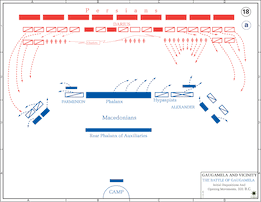
Map of the Battle of Gaugamela - Setup
The opening of the battle of Gaugamela.
Image
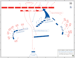
Map of the Battle of Gaugamela - Alexander's Attack
A map of the battle of Gaugamela depicting Alexander the Great...
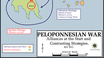
Image
Map of the Peloponnesian War, Beginning
Map of the Alliances of the Peloponnesian War, as well as the respective...
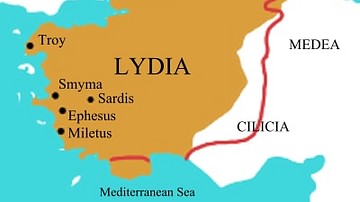
Image
Map of Lydia
Map of Lydia in the middle of the 6th century BCE. The red line...