


Map of Lydia in the middle of the 6th century BCE. The red line shows an alternative interpretation of Lydia's ancient borders.
Related Images

Image
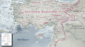
Map of Roman Rule in Asia Minor, c. 200 CE
This map illustrates the geopolitical landscape of Asia Minor during...
Image
Asia Minor in the Early 1st Century CE
Map of Asia Minor in the early 1st century CE with the Kingdom...
Image
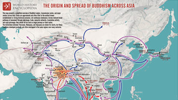
Map of the Spread of Buddhism Across Asia - The Making of a Pan-Asian Religion
Buddhism originated in the Ganges Plain of Magadha (modern Bihar...
Image
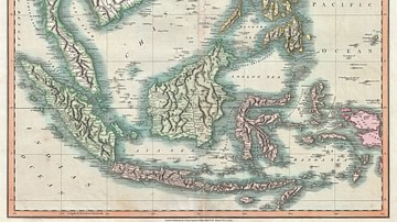
Map of the East Indies and Southeast Asia
An 1801 map of the East Indies and Southeast Asia ( Singapore...

Image
Map of Troy
Plan of the archeological site of Troy/Hisarlik. Legend: 1...

Image
Map of East Asia
A map of East Asia showing China, Korea and Japan.
Cite This Work
APA Style
Roke. (2012, April 26). Map of Lydia. World History Encyclopedia. https://www.worldhistory.org/image/155/map-of-lydia/
Chicago Style
Roke. "Map of Lydia." World History Encyclopedia, April 26, 2012. https://www.worldhistory.org/image/155/map-of-lydia/.
MLA Style
Roke. "Map of Lydia." World History Encyclopedia, 26 Apr 2012, https://www.worldhistory.org/image/155/map-of-lydia/.