
Browse Content

Image
Map of Tthe Ancient Near East c. 1700 BCE - The Old Assyrian Empire - between cities and kingdoms
Around c. 1700 BCE, the Ancient Near East was a politically fragmented...
Image
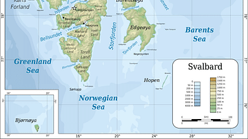
Topographic map of Svalbard
Topographic map of Svalbard archipelago (formerly known as Spitsbergen...
Image
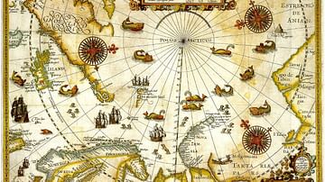
1598 Map of the Three Arctic Voyages (1594–1596) by Willem Barentsz
1598 Map of the Three Arctic Voyages (1594–1596) by Willem Barentsz...
Image
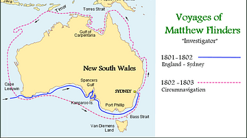
Map of the Voyages of Matthew Flinders in the Investigator
Map showing the circumnavigation of New Holland (Australia) in...
Image
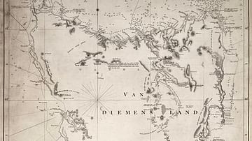
Chart of Van Diemen's Land
Chart of Van Diemen's Land (Tasmania) by the British navigator...

Image
Map of the Dominant Religions in Europe, 16th Century - Shaping Nations Through Faith: The Religious Landscape of a Changing Continent
This map illustrates the major religious divisions across Europe...