
Browse Content

Image
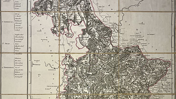
Map of the Sambre-et-Meuse Department
This antique map of Belgium shows the department of Sambre-et-Meuse...
Image
Map of the Saar Department
This antique map of Germany depicts the department of the Saar...
Image
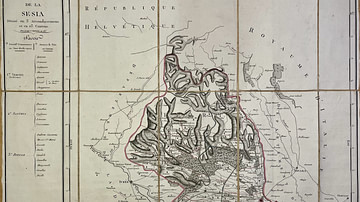
Map of the Sesia Department
This antique map of Italy shows the department of Sesia under the...
Image
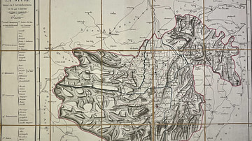
Map of the Stura Department
This antique map of Italy depicts the First French Empire’s department...
Image
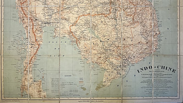
Map of Indochina by the Pavie Mission
This antique map of Indochina, dated 1909, was produced under the...
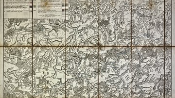
Image
Military Map of the Course of the Sambre - Campaigns and Army Positions, 1792 to 1794
This military map of the Sambre River in Northern France and Wallonia...