

Located in the arid Peruvian coastal plain, some 400 km south of Lima, the geoglyphs of Nasca and the pampas of Jumana cover about 450 km2 . These lines, which were scratched on the surface of the ground between 500 B.C. and A.D. 500, are among archaeology's greatest enigmas because of their quantity, nature, size and continuity. The geoglyphs depict living creatures, stylized plants and imaginary beings, as well as geometric figures. Source: UNESCO TV / © NHK Nippon Hoso Kyokai URL: http://whc.unesco.org/en/list/700/
Related Content
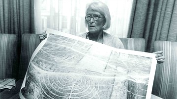
The Nazca Lines: A Life's Work
Nazca Civilization

Nazca Lines

Civilization - From Nomadic Life to the Farm and City

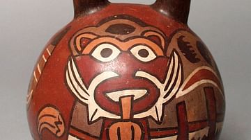
Nazca Pottery
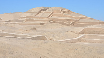
Cahuachi
Cite This Work
APA Style
Kyokai, U. T. N. N. H. (2018, July 27). Lines and Geoglyphs of Nasca and Pampas de Jumana (UNESCO/NHK). World History Encyclopedia. https://www.worldhistory.org/video/1500/lines-and-geoglyphs-of-nasca-and-pampas-de-jumana/
Chicago Style
Kyokai, UNESCO TV NHK Nippon Hoso. "Lines and Geoglyphs of Nasca and Pampas de Jumana (UNESCO/NHK)." World History Encyclopedia, July 27, 2018. https://www.worldhistory.org/video/1500/lines-and-geoglyphs-of-nasca-and-pampas-de-jumana/.
MLA Style
Kyokai, UNESCO TV NHK Nippon Hoso. "Lines and Geoglyphs of Nasca and Pampas de Jumana (UNESCO/NHK)." World History Encyclopedia, 27 Jul 2018, https://www.worldhistory.org/video/1500/lines-and-geoglyphs-of-nasca-and-pampas-de-jumana/.