
Search Images
Browse Content (p. 588)
Image
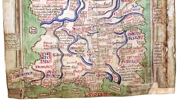
Matthew Paris' Map of Britain
Map of Great Britain by Matthew Paris (c. 1199-1259), made c. 1250. From the manuscript Epitome of Chronicles, BL Cotton MS Claudius D VI, fol. 12v. (British Library)
Image
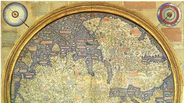
Fra Mauro Map
The "Fra Mauro Map" is one of the most accurate surviving Medieval maps, and depicts Asia, Africa and Europe with a high level of accuracy. Made by Fra Mauro in Venice, c. 1450. (Museo Correr, Venice)
Image
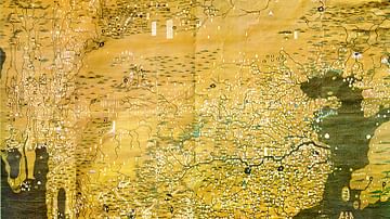
Da Ming Hunyi Tu
The Da Ming Hunyi Tu is a Chinese world map made c. 1389, during the Ming Dynasty. The map, which replicates the curvature of the Earth, centers on China but also includes Africa and Europe. 386 (151.9 in) x 456 cm (175.9). Paint on silk...
Image
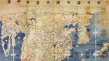
Gangnido
The Gangnido (or Kangnido) is a world map created in Korea in 1402. This version of the map was created in Japan during the Edo Period, and differs from the original. It is called the Honkōji copy, after the Honkōji temple it was discovered...
Image
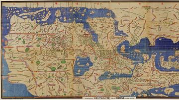
Tabula Rogeriana
The Tabula Rogeriana, as it is called in English, was made by Arab geographer Muhammad al-Idrisi in 1154. The map was commissioned by Roger II of Sicily (r. 1130-1154) around 1138, and took nearly 15 years to complete. Eight copies of the...
Image
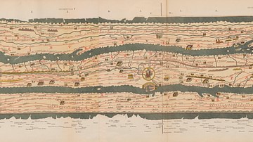
Detail of the Tabula Peutingeriana
This detail shows a section of the Tabula Peutingeriana, a 13th Century map of the world believed to be based on a Roman original. This section of it includes Rome, the heart of the Roman Empire. The massive scroll measures 0.34 m (1 ft 1...
Image
Ebstorf Map
The Ebstorf Map is a Medieval world map made by Gervase of Ebstorf c. 1234-1240. The original map was destroyed in 1943 during World War II, but several color facsimiles (including this image) survive.
Image
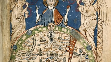
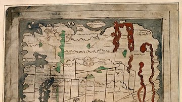
Psalter World Map
The "Psalter World Map" was made c. 1265, and depicts the world as it was known to Medieval Europeans. Approx. 9.5 cm (3.7 in) high. (Courtesy of the British Library)
Image
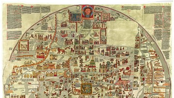
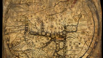
Hereford Mappa Mundi
The Hereford Mappa Mundi is a world map dating to c. 1300. It is the largest surviving Medieval map, and is based on earlier maps including the 8th Century Beatus Map. The map is attributed to "Richard of Haldingham and Lafford", also known...
Image
Anglo-Saxon Map of the World
The "Cotton Map" is an Anglo-Saxon map of the world produced during the 12th Century. The map is oriented with East at the top, and West at the bottom, in the style of many Medieval maps. The Anglo-Saxon map is sometimes called the "Cotton...