
Search Images
Browse Content (p. 533)
Image
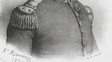
Antoine Bruny d’Entrecasteaux
French explorer Antoine Bruny d’Entrecasteaux (1737-1793).
Image
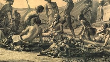
Death of Marion du Fresne at the Bay of Islands
Painting by Charles Meryon (1821-1868) depicting the death of French explorer, Marion du Fresne (1724-1772), who is surrounded by Maori with children in the background and showing parts of a pa (fortification).

Image
Map Showing Davis Island Below the Tropic of Capricorn
Ile Davis (Davis Island or Davis Land) was an island said to have been discovered in 1687 near Rapa Nui (Easter Island) by the English buccaneer Edward Davis (fl. c. 1680–1688) skipper of the Bachelor’s Delight. It is located below the Tropic...
Image
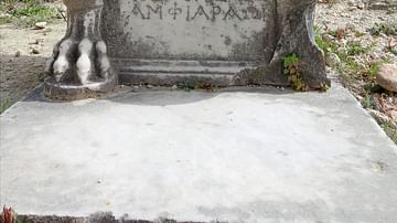
A Magistrate's Seat at the Amphiareion of Oropos
The Amphiareion of Oropos is located in the hills 6 km (3.73 miles) southeast of the fortified town of Oropos in Attica, Greece. It was a sanctuary built during the late 5th century BCE, and was dedicated to the hero Amphiaraos. Pilgrims...
Image
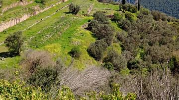
The Gymnasium of Delphi
The gymnasium of Delphi was constructed around 330 BCE. Additional works were made in various phases of the Hellenistic and Roman periods.
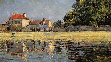
Image
Banks of the Loing, Saint-Mammès by Sisley
An 1885 oil on canvas, Banks of the Loing, Saint-Mammès, by Alfred Sisley (1839-1899), the Franco-British impressionist painter. (Private Collection)
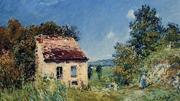
Image
Abandoned House by Sisley
An 1887 oil on canvas, Abandoned House, by Alfred Sisley (1839-1899), the Franco-British impressionist painter. (Private Collection)

Image
Le Bois des Roches Veneux Nadon by Sisley
An 1880 oil on canvas, Le Bois des Roches Veneux Nadon, by Alfred Sisley (1839-1899), the Franco-British impressionist painter. (Louvre Museum, Paris)
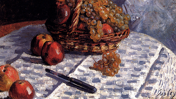
Image
Apples & Grapes in a Basket by Sisley
An 1876 oil on canvas, Apples & Grapes in a Basket, by Alfred Sisley (1839-1899), the Franco-British impressionist painter. (Clark Art Institute, Williamstown, USA)
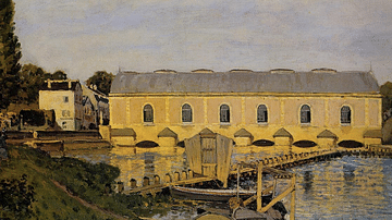
Image
The Machine at Marly by Sisley
An 1873 oil on canvas, The Machine at Marly, by Alfred Sisley (1839-1899), the Franco-British impressionist painter. This machine fascinated the artist, it was used to pump water to the magnificent gardens at Versailles. (Ny Carlsberg Glyptotek...