


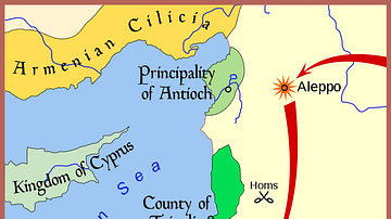
A map indicating (in red) the greatest extent of the Ayyubid Dynasty's empire (1171-1250 CE). Green indicates the areas controlled by the Crusader states (aka Latin East).
.PNG)
Related Images

Map of the Third Dynasty of Ur - Sumerian Temples, Tablets, and the Birth of Legal Tradition in Ancient Mesopotamia
Conquest of Ayyubid Syria by Mongols

Map of the First Three Crusades & the 12th-Century Outremer

The Roman Empire and the Crisis of the Third Century, c. 270 CE - Pretenders, Breakaways, Plague, and the Fight for Unity

Map of the Third Intermediate Period

Northern Crusades, 1260-1410 CE
Cite This Work
APA Style
League, A. (2018, September 11). Map of the Ayyubid Empire. World History Encyclopedia. https://www.worldhistory.org/image/9203/map-of-the-ayyubid-empire/
Chicago Style
League, Arab. "Map of the Ayyubid Empire." World History Encyclopedia, September 11, 2018. https://www.worldhistory.org/image/9203/map-of-the-ayyubid-empire/.
MLA Style
League, Arab. "Map of the Ayyubid Empire." World History Encyclopedia, 11 Sep 2018, https://www.worldhistory.org/image/9203/map-of-the-ayyubid-empire/.