Illustration
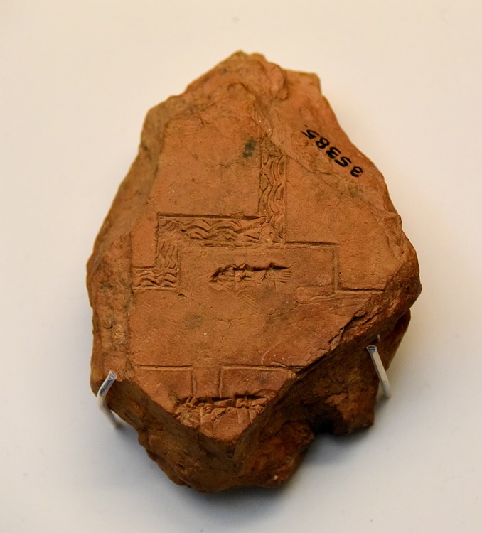
This finely made clay map of Babylon shows the Tuba area in Babylon, two gateways, a section of the city inner wall, and a gateway fed by the Rover Euphrates. The reverse side of the tablet gives accurate measurements for the city walls. Probably from Babylon, Southern Mesopotamia, Iraq. Circa 600-500 BCE. (The British Museum, Iraq)
About the Author
Cite This Work
APA Style
Amin, O. S. M. (2016, April 14). Plan of Babylon. World History Encyclopedia. Retrieved from https://www.worldhistory.org/image/4923/plan-of-babylon/
Chicago Style
Amin, Osama Shukir Muhammed. "Plan of Babylon." World History Encyclopedia. Last modified April 14, 2016. https://www.worldhistory.org/image/4923/plan-of-babylon/.
MLA Style
Amin, Osama Shukir Muhammed. "Plan of Babylon." World History Encyclopedia. World History Encyclopedia, 14 Apr 2016, https://www.worldhistory.org/image/4923/plan-of-babylon/. Web. 03 Jul 2025.


