


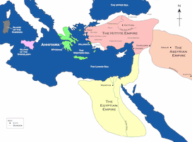
A map showing the Hittite Empire in c. 1350-1300 BCE (dark green line) and at its maximum extent (light green area).
Related Images

Map of the The Mitanni (Hanigalbat) empire, c. 1600-1300 BCE - Between Egypt and the Hittites, A Kingdom of Diplomacy and War
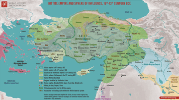
Map of the Hittite Empire 16th-13th Century BCE - Anatolian Great Power of the Bronze Age

Map of the Hittite Empire (c. 1300 BC)
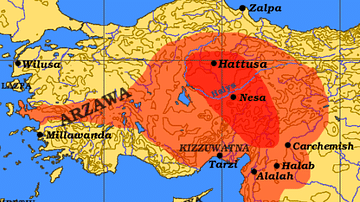
Map of the Hittite Empire and Surrounding States
Hittite Empire c. 1300 BCE

Map of the Achaemenid Persian Empire c. 500 BCE
Cite This Work
APA Style
Ikonact. (2014, August 11). Map of the Hittite Empire. World History Encyclopedia. https://www.worldhistory.org/image/2915/map-of-the-hittite-empire/
Chicago Style
Ikonact. "Map of the Hittite Empire." World History Encyclopedia, August 11, 2014. https://www.worldhistory.org/image/2915/map-of-the-hittite-empire/.
MLA Style
Ikonact. "Map of the Hittite Empire." World History Encyclopedia, 11 Aug 2014, https://www.worldhistory.org/image/2915/map-of-the-hittite-empire/.