


Venetia, part of a larger map drawing probably by Georg Braun and Franz Hogenberg, included in Civitates Orbis Terrarum, Vol. 1, p. 44, Cologne, 1593-1618.
This is an aerial view of what the Arsenal looked like in late 16th- or early 17th-century Venice. This is the rightmost corner of a much larger depiction of Venice with merchant ships and gondolas dotting the water. Workers can be seen working on a new ship within the Arsenal in the top right section of the complex.
Library of Congress Geography and Map Division, Washington, D.C.
Related Images

Map of the Expansion of the Roman Republic (c. 260 - 30 BCE)

Map of the Roman Conquest of Italy

Map of the Roman Republic on the eve of the Mithridatic Wars

Political Map of Italy circa 1000 CE

Map of Odoacer's Italy in 480 CE
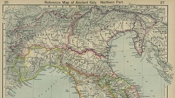
Map of Ancient Italy, Northern Part
Cite This Work
APA Style
Hogenberg, G. B. a. F. (2025, August 22). Map of Venetian Arsenal. World History Encyclopedia. https://www.worldhistory.org/image/20883/map-of-venetian-arsenal/
Chicago Style
Hogenberg, George Braun and Franz. "Map of Venetian Arsenal." World History Encyclopedia, August 22, 2025. https://www.worldhistory.org/image/20883/map-of-venetian-arsenal/.
MLA Style
Hogenberg, George Braun and Franz. "Map of Venetian Arsenal." World History Encyclopedia, 22 Aug 2025, https://www.worldhistory.org/image/20883/map-of-venetian-arsenal/.