
Server Costs Fundraiser 2026


The Crusader States, collectively known as Outremer (from Old French outre-mer, “overseas”), were a group of Latin Christian polities established in the eastern Mediterranean following the First Crusade (1096–1099). Emerging from the conquest of former Byzantine and Muslim-ruled territories, these states expanded and consolidated during subsequent campaigns, including the Second Crusade (1147–1148) and the Third Crusade (1187–1192). At their height in the 12th century, Outremer comprised several distinct yet interconnected entities, most notably the Kingdom of Jerusalem (1099–1187), the Principality of Antioch (1098–1144), and the County of Edessa (1098–1144), stretching along the Levantine coast and into parts of Anatolia, with later strategic reliance on Cyprus (from 1191).
These states developed within a fragmented and highly contested political landscape shaped by interactions between Western crusaders, the Eastern Roman (Byzantine) Empire (395–1453), and powerful Muslim dynasties, including the Seljuks (1037–1194), Zengids (1127–1185), and Ayyubids (from 1171). Rather than functioning as a unified empire, Outremer consisted of fortified urban centers, castles, and military corridors sustained by both overland routes and Italian maritime supply networks. Key strongholds, such as Krak des Chevaliers, Chastel Rouge, and Chastel Pèlerin, were essential to defense, communication, and control of territory.
About the Author

Related Images

Map of the Seljuk Sultanate of Rum, c. 1200

Map of the First Three Crusades & the 12th-Century Outremer
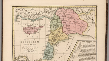
Kingdom of Jerusalem at the Time of the Crusades

Map of the First Crusade, 1096 - 1099

Map of the Mamluk Sultanate of Egypt c. 1330 - Slave Soldiers Who Ruled an Empire

Map of the Rise of the Delhi Sultanate: The Mamluk Period - From Slave Commanders to Sultans
Cite This Work
APA Style
Netchev, S. (2026, January 28). Map of the Crusader States (Outremer), 1096-1291. World History Encyclopedia. https://www.worldhistory.org/image/20583/map-of-the-crusader-states-outremer-1096-1291/
Chicago Style
Netchev, Simeon. "Map of the Crusader States (Outremer), 1096-1291." World History Encyclopedia, January 28, 2026. https://www.worldhistory.org/image/20583/map-of-the-crusader-states-outremer-1096-1291/.
MLA Style
Netchev, Simeon. "Map of the Crusader States (Outremer), 1096-1291." World History Encyclopedia, 28 Jan 2026, https://www.worldhistory.org/image/20583/map-of-the-crusader-states-outremer-1096-1291/.