
Illustration


This antique map of India illustrates the Indian Rebellion of 1857, also known as the Sepoy Mutiny. It was published by J. Barthelemier, successor to Ch. Picquet. The map provides a geographical overview of the uprising, reflecting key locations and areas affected during this major event in colonial history. Source: Votre Carte Ancienne – antique maps of India.
About the Author

Related Images
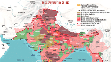
The Sepoy Mutiny of 1857
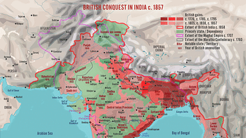
British Conquest in India c. 1857

Map of the British Raj c. 1930

Map of the World in the 14th Century
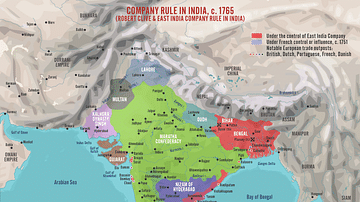
Robert Clive & The East India Company Rule in India, c. 1765

Map of the Trade in the Indian Ocean 15th-16th century
Cite This Work
APA Style
Denis, L. (2025, May 27). Map of the Indian Rebellion of 1857. World History Encyclopedia. Retrieved from https://www.worldhistory.org/image/20489/map-of-the-indian-rebellion-of-1857/
Chicago Style
Denis, Léopold. "Map of the Indian Rebellion of 1857." World History Encyclopedia. Last modified May 27, 2025. https://www.worldhistory.org/image/20489/map-of-the-indian-rebellion-of-1857/.
MLA Style
Denis, Léopold. "Map of the Indian Rebellion of 1857." World History Encyclopedia. World History Encyclopedia, 27 May 2025, https://www.worldhistory.org/image/20489/map-of-the-indian-rebellion-of-1857/. Web. 01 Jul 2025.