


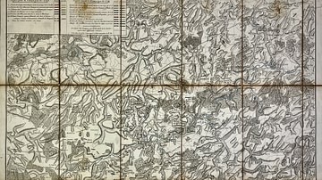
This military map covers the French border region from Maubeuge to Douai and was designed to support the understanding of the campaigns conducted between 1793 and 1794. It details the positions of French and Austrian forces during this phase of the War of the First Coalition, providing a valuable geographic reference for military analysis. Source: Votre Carte Ancienne – antique maps of France.
About the Author

Related Images

Map of the First French Empire and Napoleonic Europe, 1812
Military Map of the Course of the Sambre - Campaigns and Army Positions, 1792 to 1794

North America in the French and Indian War 1754–1763 - A Colonial War and the Roots of American Revolution

Map of the French Revolution and Wars 1789-99

Map of Africa in World War II
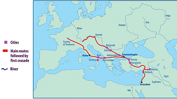
Map of the First Crusade Routes
Cite This Work
APA Style
Denis, L. (2025, May 23). Military Map of the French Border, Maubeuge to Douai: Campaigns of 1793–1794 With Army Positions. World History Encyclopedia. https://www.worldhistory.org/image/20477/military-map-of-the-french-border-maubeuge-to-doua/
Chicago Style
Denis, Léopold. "Military Map of the French Border, Maubeuge to Douai: Campaigns of 1793–1794 With Army Positions." World History Encyclopedia, May 23, 2025. https://www.worldhistory.org/image/20477/military-map-of-the-french-border-maubeuge-to-doua/.
MLA Style
Denis, Léopold. "Military Map of the French Border, Maubeuge to Douai: Campaigns of 1793–1794 With Army Positions." World History Encyclopedia, 23 May 2025, https://www.worldhistory.org/image/20477/military-map-of-the-french-border-maubeuge-to-doua/.