


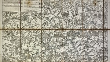
This historical map of the Genoa River was produced to support the understanding of military operations from 1792 to 1800, with particular focus on the events of Montenotte and Mondovì in 1796. It provides a detailed representation of French and Austrian positions, offering key insight into the strategic geography of these engagements during the Italian campaigns. Source: Votre Carte Ancienne – antique maps of Italy.
About the Author

Related Images
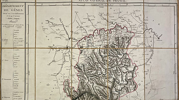
Map of the Genoa Department
Military Map of the Course of the Sambre - Campaigns and Army Positions, 1792 to 1794

Map of Niger River

An Illustrated Map of Medieval and Early Modern Europe (From the Novel "The Jericho River")
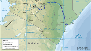
Map of Kenya with Tana River Indicated
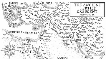
A Map of the Ancient Fertile Crescent (From the Novel The Jericho River)
Cite This Work
APA Style
Denis, L. (2025, May 23). Map of the Genoa River and Military Operations: Montenotte and Mondovì, 1796. World History Encyclopedia. https://www.worldhistory.org/image/20471/map-of-the-genoa-river-and-military-operations/
Chicago Style
Denis, Léopold. "Map of the Genoa River and Military Operations: Montenotte and Mondovì, 1796." World History Encyclopedia, May 23, 2025. https://www.worldhistory.org/image/20471/map-of-the-genoa-river-and-military-operations/.
MLA Style
Denis, Léopold. "Map of the Genoa River and Military Operations: Montenotte and Mondovì, 1796." World History Encyclopedia, 23 May 2025, https://www.worldhistory.org/image/20471/map-of-the-genoa-river-and-military-operations/.